YOUR
GUIDED TOUR

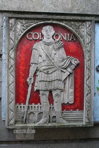
In or around the year 42 AD, Cunobelin, leader of the British tribe known as the Trinovantes, died. Cunobelin was arguably the most powerful king in Britain, and his death resulted in an inevitable power struggle over who should succeed him. The Romans seized the opportunity and invaded Britain, making their priority the capture of Camulodunum (now known as Colchester). So, they decided on a plan to keep a watchful eye over their new subjects, by building a fortress on a nearby hill. Despite some initial skirmishes, they appear to have met little resistance from the Brits - but they must have expected some sort of retaliation. Within a very small time period, probably because the indigenous Brits showed that they accepted a peaceful life, it was soon de-fortified and became a colonia - a place of peace, where retired Roms could live and enjoy the land that was now theirs. Here was the first capital of Roman Britain.
Colchester town centre (as we know it today) was once known as the Colonia Victricensis (loosely translated as 'City of Victory'). Whilst it started off as a legionary fortress, it was as an unfortified colonia that it was attacked in the year 60 or 61 AD and destroyed by Boadicea, Queen of the Iceni. I will be frequently referring to the word 'colonia' for these reasons.
A colonia was a place where Romans lived; in this case, retired Roman soldiers. A municipia, by contrast, was a place of lesser status where the British people mainly lived. Verulamium (now known as St Albans) was a municipia.
The colonia took the British name of the surrounding area, the whole becoming known as Camulodunum. This, of course, eventually became now known by its current name of Colchester (colne ceastre - fortress on the Colne).
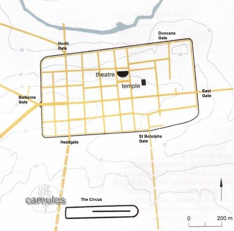
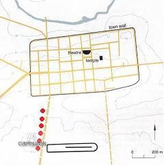
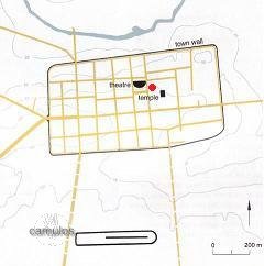
MAP The map shows a simplified layout of the Roman colonia from around 200AD.
Hopefully, from this map, you will be able to identify the various gates in the walls and therefore the Balkerne Gate on the west, East Gate on the East, linked by the Via Principale (our modern day High Street). Also the North Gate on the north and Headgate on the south east, linked by modern day North Hill and Head Street. Also the South Gate where present day St Botolphs Street passes through, leading south toward the circus.
(Further to the south, not shown on this map lies modern day Gosbecks, where, before the Roman invasion, lived the British people of the Trinovante tribe. We will visit there as an addition to this tour, at the end of the page.)
I will use this map to indicate (with red dots) where we are as we walk around the modern day town, where I will show you the evidence of what has survived from Roman times.
1 - THE TOWN HALL
We start our tour at our modern day own Hall, in what would have been the centre of the colonia, and, coincidentally, the probable location of the principia, the main headquarters of the Roman colonia. The modern day High Street follows the original line of the Roman street that would have been laid out by the Romans in or around the year AD 43 in an almost perfect east/west alignment. They had a 'fresh canvas' to work with. At that time there would have been no other buildings, with the only pre-Roman archaeological finds being burials and assorted pottery dating perhaps as far back as 2500 BC (Beaker), and pre-history flint tools and arrowheads, etc. We assume that, to the Iron Age British, this would have been a sacred place where their ancestors were buried and a high place that could be seen in the distance.
The Romans built their town here because it was a logical next step to the fortress that they built here to 'keep an eye' on the unpredictable 'Brits' over in Camulodunum (modern day Gosbecks and Sheepen). The surrounding landscape would have been forest - the essential fuel for cooking and, perhaps more importantly, for enabling the making of bricks and roofing tiles for buildings.
The colonia was built on a hill, at a height above sea level of some 30 metres. In so doing, the Romans' main problem was a lack of water! That is why the wise old Brits lived in the areas known today as Sheepen and Gosbecks, where they had plenty of fresh water and could easily defend themselves.
The new Roman occupiers needed to carry or convey, by some means, water to the colonia - something that must have been a major headache for them.
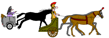
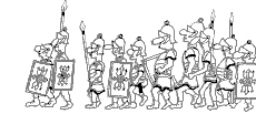
The Conquering Roms
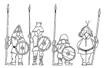
The Brits of Camulodunum
So, let us set off to our second Roman point of interest.
2 - THE ROMAN THEATRE
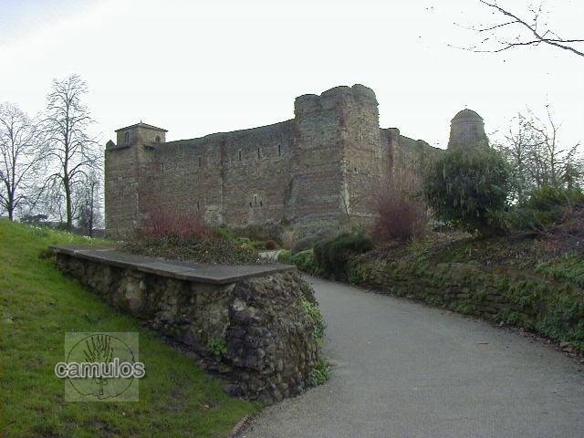
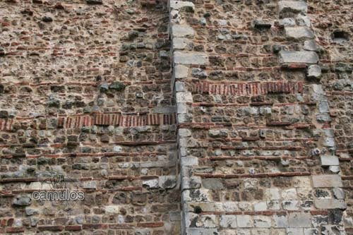
To reach the Roman Theatre in Maidenburgh Street, we must walk down West Stockwell Street, to the side of the Town Hall, passing the first public library and the St Runwalds church graveyard on the left, until we reach St Martin's Church on the right hand side. A little further down the road on the right is the Taylor house where the nursery rhyme 'Twinkle, twinkle, little star' was written. Stop a while to look at the church and note the use of the recycled Roman period materials. Remember that Essex has no natural building stone, something that the Romans found to their cost. Long after they left Britain, Colchester had fallen into decay. However, the Normans found a ready made supply of building materials in the Roman debris and a new life was given to the town with the building of our Norman and medieval churches and, of course, our magnificent castle - as well as many other buildings and structures.
To the left of the church is a small alleyway know as Quaker Alley, in memory of the many nonconformists of the area at one time and an introduction to what we know as the Dutch Quarter. Walk to the end of the alley and you will find yourself in East Stockwell Street. This is an area once inhabited by Flemish weavers, who had fled persecution on the continent and found sanctuary in Colchester from the 16th century. Turn left and then first right, along St Helen's Road?, with the Stockwell Chapel on your left. On the right you will find an open grassed area that is a Quaker burial ground, no longer in use but preserved for posterity.
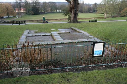
At the end of this road you come to Maidenburgh Street, with the St Helena Chapel on your right hand side. During roadworks in the 1980s a Roman period structure was discovered, on top of which the chapel was built. Upon further archaeological investigation it was found that this was a Roman theatre.
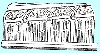
The photograph looks south, up Maidenburgh Street, with St Helena's Chapel in the centre. Picked out in the block paved road surface are blocks of different colour to mark the location of the theatre foundations below ground level. Further up, a building has been rebuilt in order to display these foundations.
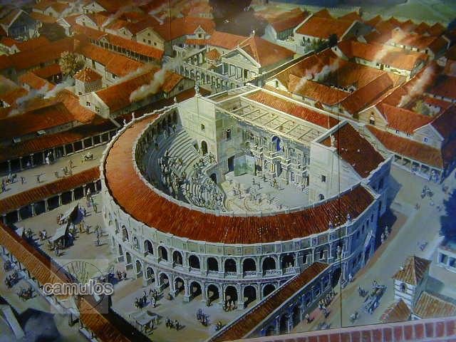
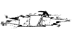
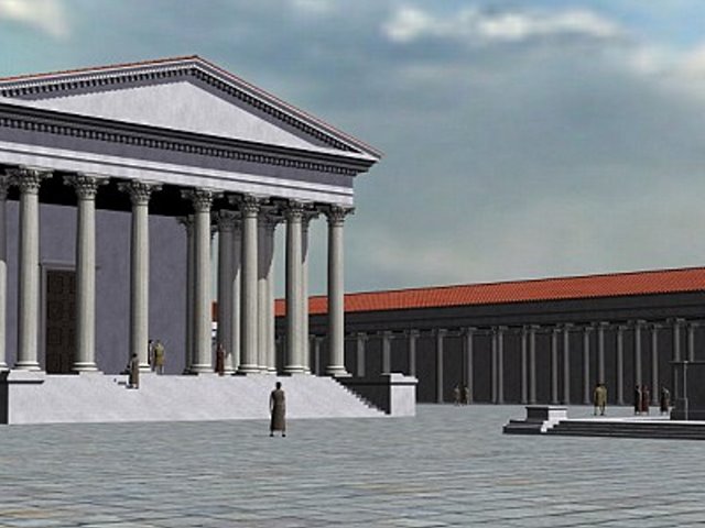
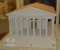
The following picture shows how we think the theatre might have looked. In keeping with the relaxed and unwarlike image that the Romans wanted to convey to the British, for the colonia, a place of culture and learning, a place where its soldiers could retire in peaceful surroundings, theatres were where plays or oratory could be seen and heard.
An Amphitheatre?
A theatre, semi-circular in shape, is not to be confused with an amphitheatre, oval in shape, where gladiatorial battles, putting Christians to death, or other such barbaric practices, were the norm.
No amphitheatre is known in Colchester. But who knows?
The dreamers believe that there MUST be one. One day perhaps, one may be found, to confound the theory of a peaceful colonia.
In the meantime, we at Camulos will continue to believe that the Roman circus was considered to have been both more than splendid an asset for the colonia, and also easier to construct using the materials available. With the colonia's lack of building stone, something that an amphitheatre, with its greater height, would have needed, it would have been an engineering nightmare.
So, let us set off to our third Roman point of interest.
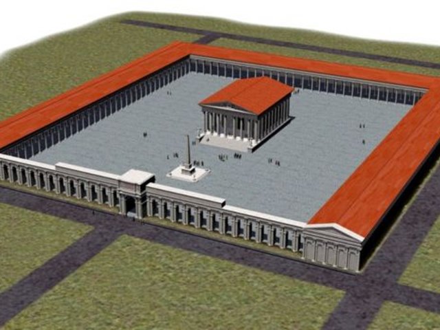
3 - THE TEMPLE OF CLAUDIUS and the CASTLE GROUNDS
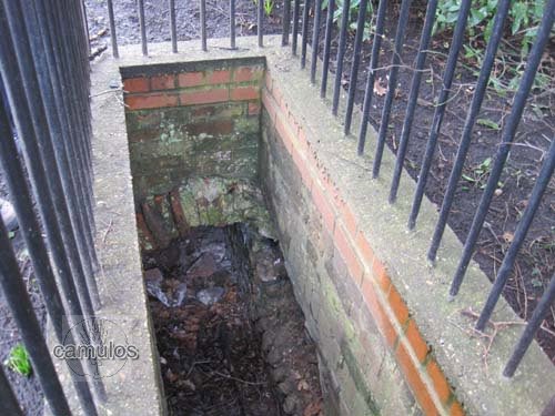
Close to St Helena's Chapel, on the opposite side of the road, is another alleyway. Go down the alley and you will find a small gateway that leads you into the upper castle park. Walk up the incline toward the castle and, after a short distance, you will see a section of wall to the left of the path. This is a section of the Roman wall that once surrounded the precinct of theTemple of Claudius, built to glorify the name of the Emperor Claudius. The Normans built their castle's defensive bailey wall over this Roman wall and we assume therefore that much more of it passes into the earth bank to the left. Subsequent landscaping has removed much of this Roman boundary wall but, a short way away, to the right of this picture, hidden in the undergrowth, is a section of a drain belonging to the Roman period, a reminder of the advanced technology that the Romans brought with them to uncivilised Britain. This section of barrel drain points directly towards the castle, so would have been there to take care of the drainage and sanitary needs of the temple.
Go here to get an idea of what the Romans gave to us.
We are now in true Roman territory! Our splendid Norman Castle was built so that it embraced the podium of the Temple of Claudius. The Normans must have realised the spiritual and authoritative significance of this site when choosing where to build their castle. The precinct walls (including the massive arcade on the south face), together with the temple sturcture itself must have been largely intact when the Normans came. They must have torn it all down to use the materials to build their castle.
In the foreground, a section of the precinct wall that would have surrounded the Temple of Claudius.
A view of one of the many Roman barrel drains that have been discovered. This one points directly at the castle, suggesting that it was part of the temple's drainage system and leading north to perhaps discharge outside the colonia wall.
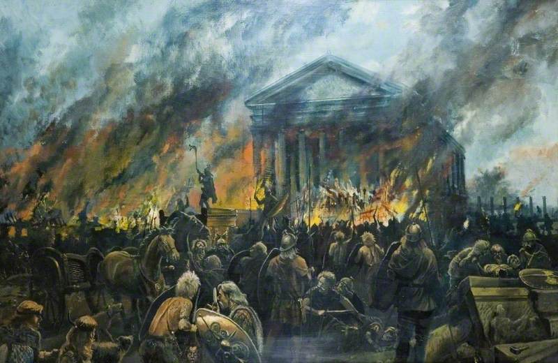
The temple was destroyed in 60/61 AD by Queen Boadicea's army, when, according to the Roman commentator Tacitus, 30,000 Romans lost their lives. Many had barricaded themselves inside the temple in the vain hope that they might survive the attack. Today, archaeologists regularly find a burnt layer in the earth when digging down - an indicator and reminder of the date and the event.
As we stand looking at the section of temple precinct wall, just imagine how this area might have looked some 1900 years ago. The temple would have been rebuilt after the destruction by Boadicea. The temple precinct would have been a place where one could relax, talk to friends. We have no way of knowing exactly what was there but it must have been a focal point in Roman Colchester. Before we walk up to the castle, let's turn left, to the north, down the path where we will see the Victorian bandstand. Before we get to the bandstand, there is an area that has been left exposed by archaeologists in the 1930s (nowadays they would have covered it all up again). This is the remains of one of the many Roman town houses that we know were here. The red clay tessarae of the floor and stones marking where the building's walls once were, are well displayed and give us an idea of how a typical house might have been laid out. You may think it surprising that such evidence of the past is open to the weather like this.
The remains of a c200AD Roman house.
Can you see the town's Roman wall in the distance?
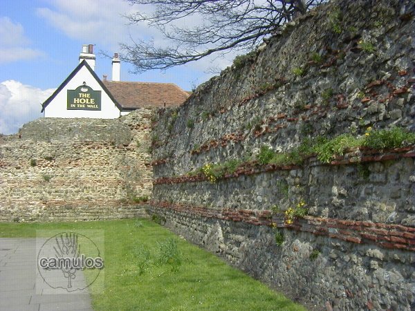
From this position, what is left of the 2800 metre long Roman colonia wall can be clearly seen at the foot of the hill that has since become part of our award winning Castle Park.
Turning back on ourselves we now return to the Norman castle to see more evidence of the Roman period. Apart from the extensive use of Roman materials for the building of the castle, there is very little evidence of the Roman period. After the Romans left Britain around 411 AD, the colonia would have gone into rapid decline. With the collapse of effective government, law and order, a workable money system, etc. life within the colonia was unsustainable. Without commerce, a profit could not be earned and life took a far less comfortable turn. In order to eat, food had to be grown rather than purchased. History does not record how people fared but we must assume it became a case of survival of the fittest and law of the sword. This was what we now term 'The Dark Ages'. The colonia would have simply decayed, only to be repopulated sporadically by the Saxons, the Danes and, eventually, the Normans; the latter using the 600 year old Roman debris to build their Norman buildings - many of which survive today. Thankfully the strategic importance of the town walls was recognised and they were preserved and repaired over the centuries; most of them surviving to this day.
Let's make our way eastwards around the east side of the castle and across to the children's play area, passing by our Royalist martyr's obelisk. As we pass the castle, look for evidence of hypercaust pillars that were used by the Normans in building the castle. The higher status Roman houses had underfloor heating. The floors were raised up by about 500mm on pillars made from brick tiles. The space created was then used to convey heat from a fire to hollow wall tiles that acted as chimneys. This passage of heat warmed the whole building, especially the floors.
Can you see the hypercaust tile pillars laid on their side in the castle wall?
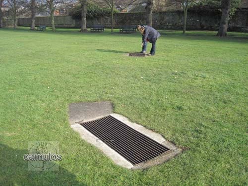
Beneath these grates in Hollytrees Meadow are some very well preserved Roman drains that lead down to Duncan's Gate.
On, what we refer to as, Hollytrees Meadow, close to the children's player, can be seen two metal grates set into the grass. Below these grates is further evidence of Roman drains, these being in remarkably good order and man sized. They lead down to Duncan's Gate to the north, in the colonia wall. The archaeologists are undecided as to whether this drain system is part of a Roman mithraic temple structure. One theory is that the drains could have offered an escape route out of the colonia for important people, should the colonia be besieged. A strange type of frog lives in these drains!
Of course, the castle is our principal museum too and there is an extensive collection of Roman period exhibits. Whilst we are not venturing inside the castle during this tour, please visit, if you get the opportunity, to see some of the exhibits that have been discovered over the years and may still be on view to visitors.
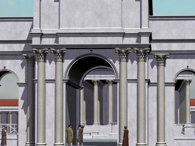
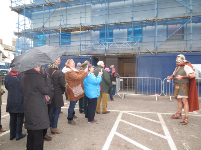
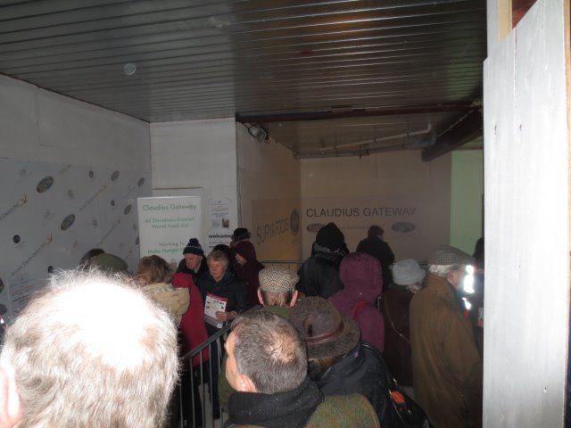
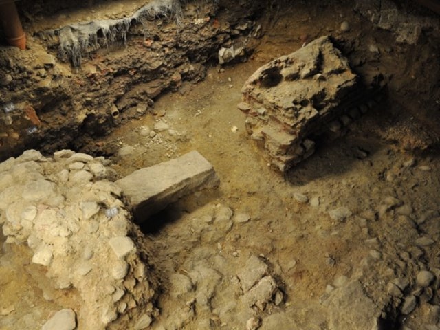
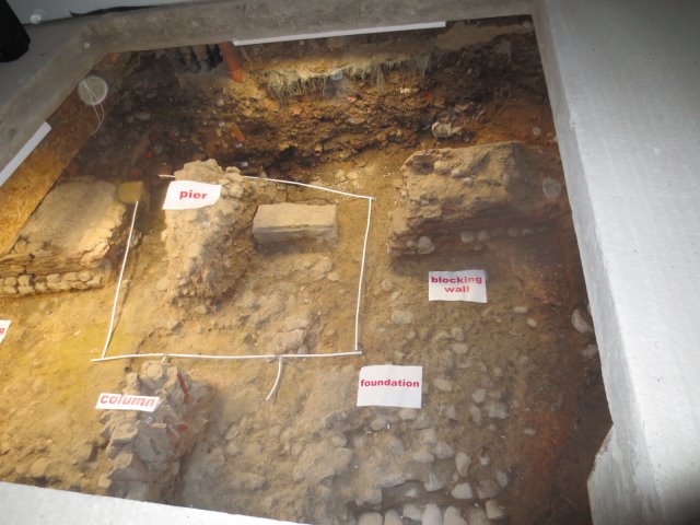
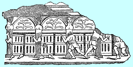
In the 1920s, a series of Roman period foundations were found to the south of the castle, close to the High Street, which proved the position of the arcade that would once have formed the boundary of the temple precinct. Over the years, more evidence of it was found and covered up again, until, in 2015, an extensive part of it was uncovered and a decision taken by the property owners to place it on permanent display. In February 2016 a public viewing was arranged, ahead of the completion of the newly constructed building that would sit on top of this archaelogical feature.
Some amazing graphics have been created for the project. In the centre we see the Temple of Claudius. The remains of a Roman Monumental Arcade, with a series of 28 arches, formed part of the gateway to the temple, with a central grand gateway. An interpretation centre with a café will share the ground floor of Castle House with the newly discovered artefacts.
Suki Dulai, managing director of George Hotel owners Flying Group PLC, decided to preserve the arcade, after previously planning to open a restaurant at the town-centre site. He said: “After the discovery of Claudius Gateway, we’ve decided to preserve and celebrate our history with the community of Colchester.”
The central archway through which processions would have passed on important days.
13th February 2016 and the general public get an opportunity for a look at the remains, with a Roman auxilary soldier watching over these unruly plebians..
As the exhibit develops, we will show further details. Better still, why not pay us a visit?
4 - TOWARDS SOUTH GATE
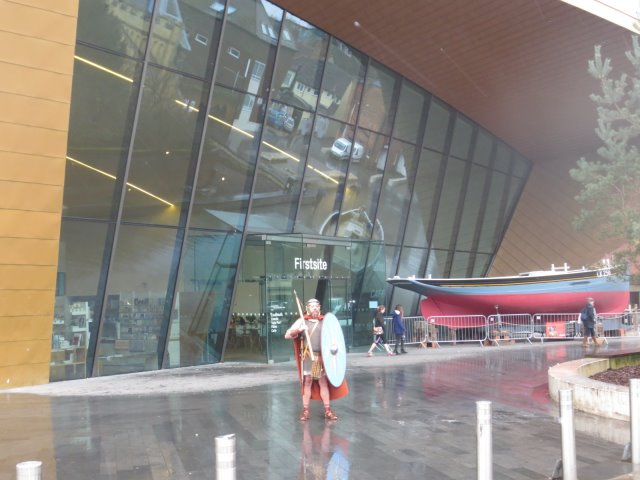
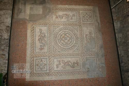
Next we will turn back toward the castle and walk north, back into the castle park and then to the right and out of the park via the Cowdray gate by the war memorial. Crossing the High Street and walking to the left of All Saints Church (now our Natural History Museum), we are in Queen Street. Walk down Queen Street and note on the left, the magnificent new structure that is our Firstsite art gallery. It has, as part of its attractions (since 2010), a Roman mosaic, known as the Beryfield mosaic.
When archaeologists uncovered it in the 1920s, they discovered a skeleton laid on it. Whether this was evidence of foul play, we shall never know.
One rainy day in Camulodunum, outside Firstsite where once, in Roman times, must have stood many Roman buildings. One, in particular, was of high enough status to have a wonderful mosaic on its floor.
This is what is known as the Beryfield mosaic, previously located in the entrance hall of the castle, but now under a glass floor at Firstsite.
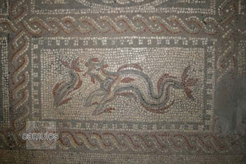
....and a close-up of one of the mythical creatures.
Queen Street does not appear to be an original Roman road but it does lead us down to, by a dog-leg deviation, to the Roman road where once would have stood St Botolphs Gate or South gate - or whatever name the Romans may have given it. There would originally have been a road to the right that led directly from the temple, through South Gate and up to the Roman circus. The gate was removed for good in the 17th century, probably due to decay and inconvenience for ever larger road vehicles - and perhaps as a result of damage during the Siege of Colchester of 1648. I have nothing that is Roman to show you on this route, unless you want to turn left along Priory Street to see a further section of the town wall and the nearby St Botlph's Priory, built almost entirely from re-cycled Roman period materials. Instead, let us take the road on the right named
Vineyard Street in what has become St Botolph's Street, to go and see a further section of our Roman wall. After about 100 metres, on the right, we see that Vineyard Street opens out into a car park, with a fairly messy section of what is left of the Roman wall, much altered, repaired, due to centuries of the presence of various buildings built into and onto the wall, some sections having lintels from fireplaces and other repaired breached.
Following the line of the wall. Near to the modern period stone steps that lead up on to what would have been the wall ramparts (now Eld Lane), we can see a restored and well preserved barrel vaulted Roman drain outlet. This is just one of many outlets that would have existed in the wall. You would need to follow the wall walk to see other evidence of Roman drains. A little further on from that is a much larger breach in the Roman wall that was made by the builders of our modern day Lion Walk Precinct. But let's not get distracted by detail as this is covered by the Roman Wall trail elsewhere on Camulos.
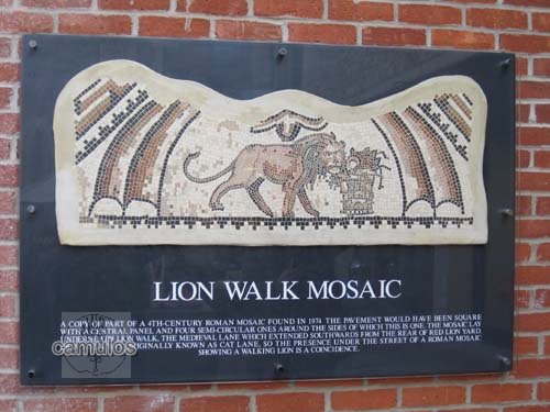
If we we briefly take a detour up the above mentioned steps and into Lion Walk, we can see a modern plaque on a shop wall, describing a lion like creature that was part of a Roman mosaic found nearby by archaeologists.
So, back to Vineyard Steps and outside the town walls, to continue the trail. Vineyard Street is a modern naming and does not (sadly) refer to an area used by the Romans to grow the grape. This was, at one time, Colchester's red light area! A renaming of the area must have helped with its reputation. That is another story, covered by our pages about our military heritage.
5 - TOWARDS THE CIRCUS
Keep walking westwards along the line of the wall until you come to Scheregate Steps. This is where another breach in the wall occurred, probably in the Middle Ages, when a Roman drain was opened up to produce a walk through for workers at the nearby St John Abbey. The steps demonstrate yet again the difference in height between inside the walls and outside them. This would have been around 6 metres in Roman times but later life has reduced this somewhat to a gentle slope and a few steps.
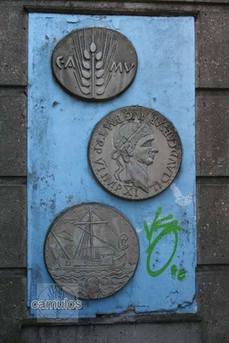
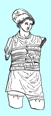
Opposite Scheregate Steps, to our left, is a road imaginatively named Abbeygate Street. Turn down this street and walk under Southway via the underpass towards St Johns Abbey Gate. In the underpass you will see modern murals depicting some historical themes. You will see a replication of the tombstone of a Roman centurion, Marcus Favonius Facilis, the original of which can be seen in the castle. He died around AD 50. The wallpaper of this web page shows a Roman auxiliary soldier by the name of Longinus Sdapeze, whose incredibly well preserved tombstone is also to be seen in the castle. Other murals in the underpass show the detail shown on a pre-Roman period British coin with an ear of corn (the source of the great wealth of the region that so attracted the Romans here) and the letters CAMU (short for Camulodunum, believed to be the British name for Colchester at that time).
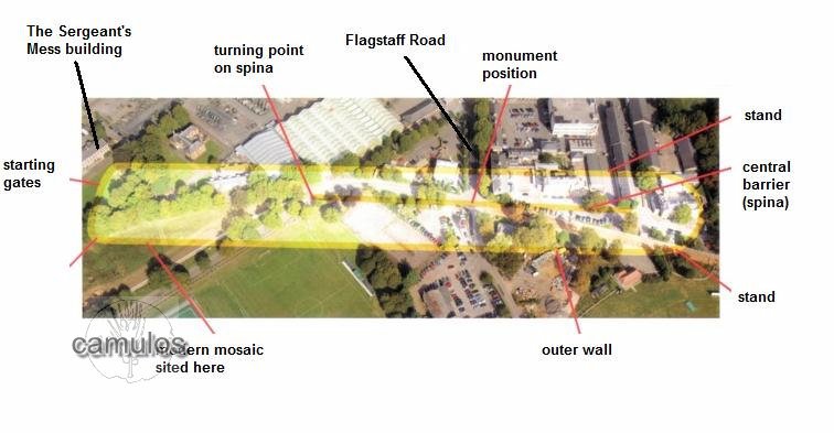
Emerging from the underpass, turn left and walk up the hill for about 200 metres, passing the abbey gateway over on our left. We are now in Flagstaff Road. Before the junction that we see ahead, about 50 metres ahead, we cross over the northern section of the Roman circus that was identified by archaeologists at the end of 2004. This came about as a result of the army relocating to another part of the town and selling the army land (since Victorian times) to developers. As part of legal requirement of the sale, archaeological assessments had to be done prior to any building works, in case anything of historic importance was hidden. Archaeologists had discovered various bits of a Roman period structure in past years but no significance was attached to the finds until then. On finding yet another piece of the structure that seemed to line up with other previous finds, somebody remarked on what might be the worst thing that could be found in Colchester from a property developer's perspective.
Charioteers? A Roman circus perhaps. Bingo! Gradually it had dawned on the archaeologists that what they had unearthed were the remains of the only Roman circus known in Britain. Over the following period, more and more of the circus was discovered and the rest - as they say - is history.
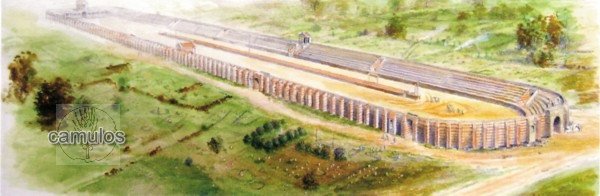
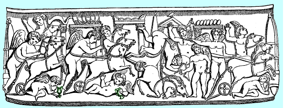
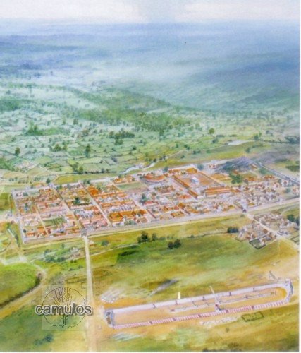
The illustration below shows a view of how the circus probably looked from the Emperor Hadrian's period circa 117 - 138 AD. Perhaps Hadrian himself had ordered the construction of the circus.
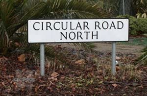
At the junction of Flagstaff Road and Circular Road North, stop and imagine how things once were at this position. From your right, some 200 metres away, were the eight starting gates of the circus where up to eight teams of four horse pulled chariots (quadrigae, or biga for two horses) started, all aiming for the best line that they could get to race around the 440 metre long circuit with its 800 metre lap. To your left, about another 200 metres or so, was the other end of the circus where the charioteers thundered around a turning point and back toward the starting gates and to complete their first lap. To get a feeling for this take a little detour and search for a clip from YouTube that shows the incredibly filmed race in the film Ben Hur, with Charlton Heston as Judah Ben Hur, racing around the biggest Roman circus ever built, the Circus Maximus in Rome, Italy.
Of course, that was Hollywood. The reality would have been no less exciting, but the chariots would have been much lighter and with no nasty pointy bits on the wheels to nobble the opposition's chariot. This was the Formula One racing equivalent of Roman times with the most successful charioteers earning huge sums of money and being hailed as gods in their own right. It must have been incredibly dangerous for horse and man and would have been watched by an audience of tens of thousands of people. Standing at this junction you would have been mown down, so with that thought in mind, let us move on. Turn right along Circular Road North (we must rename that road to reflect what we now know about its past history) we will walk for about 100 metres until we reach a bend in the road, where one of the turning points in the central spina of the circus once stood (archaeologists found its foundations still intact). Slightly ahead to the left can be seen a grassy mound in the grassed area.
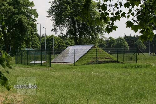
Soon after the discovery of the circus, local children set about a mammoth task of creating a modern mosaic. Once constructed, a mound was raised on a section of the circus to both simulate the type of banking used for the circus walls and to enable the mosaic to be displayed. The following picture shows the mosaic soon after it was set in place.
It has now been relocated at nearby Roman Circus House and the mound flattened.
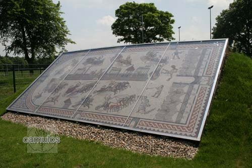
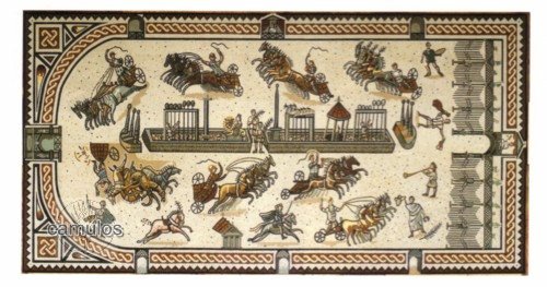
The following picture by Pete Frost, shows the design of the mosaic. It is a wonderful piece of work and shows how (it is thought) the circus would have been laid out.
Having been located outside for some years, it deteriorated and has since been restored and relocated at Roman Circus House.
Here are some scenes from ancient monuments that depict some of the features of the Roman circus. Note the charioteers
hooked knife in his webbing, there in case of emergency to
cut himself free of the reins that could drag him to his death.
Also details of the various gates of the circus.
Here follows an aerial view of how the circus lies in relation to modern day buildings and roads. Some 1400 years after the Romans left Britain, the army (in the 1870s) built their barracks in this area. In the 2000s the army moved on and sold the land to developers. When it was discovered that a Roman circus lay below the soil, a Scheduled Ancient Monument classification was quickly slapped on it, thus ensuring that no harm could be done to it, or anything built on top of it. This was a serious inconvenience to the developer. Local people started a campaign to bring the land back into public ownership. They quickly met the problem that the circus strarting gates lay in the gardens of the old Sergeant's Mess building (far left in the picture below) and the developer would not sell the garden on its own. So, the campaign set to work in late 2009 to raise the £750,000 that the developer wanted for the building and its garden. As it turned out, we failed to buy the building, but instead, the nearby 1930s NAAFI building was acquired. It became the base for the Colchester Archaeological Trust and is open to the public as a cafe and interpretation centre.
The following picture shows how, Pete Frost, a local artist, saw the landscape being at the time of when the circus was built. The circus lies in the foreground east west and parallel to the colonia.
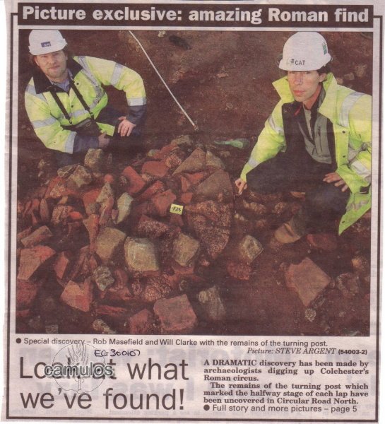
The following newspaper clipping shows just one of the fascinating finds that were uncovered by archaeologists.
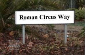
Before we move on, reflect on the fact that, since 2004, when the circus was discovered, there is no indication for visitors to tell them where the circus lies. The road is named 'Circular Road North'. What might it take to get the road name changed to 'Roman Circus Way'?
The most likely reason for this is that Colchester Borough Council wants people to visit the town centre and spend money, rather than to come here, to a privately owned, free to access, place of history. How sad is that?
6 - THE ROMANO-CHRISTIAN CHURCH

Having visited the only Roman circus site in Britain, we will now walk back towards the colonia and visit the earliest Christian church in Britain. Taking the passageway through from the circus site to Butt Road (perhaps named because of the rifle shooting butts that were created for the military during Victorian times in this area), we turn to the right (heading north) back into town and past two of our traditional pubs, the Fat Cat (previously the Royal) and the Dragoon. At the foot of the hill, on the left, you will see our Police Station.
In the 1960s, we constructed a new road system that was to eliminate traffic congestion in the town centre. That was clearly a bit of a joke, as we all now know that was an impossible task. However, in so doing, a new police station was planned as part of the work, and an archaeological survey was organised to see what was lay under the soil.
It had long been known that there was a Romano-British cemetery in the area, as people along Butt Road had been digging up the evidence for many years.
When the Victorians built their houses along Butt Road, Maldon Road and the interconnecting roads, they must have just ignored what lay below.
Just outside the Head Gate area of the Roman Colonia, adjacent to the present day Police Station, was discovered the remains of this church-like structure, dateable to AD 320 - 340. The Romans officially tolerated Christianity in 313 under the Emperor Constantine, and we therefore claim that this church is the earliest known Christian church in Britain.
In Roman times, the dead were not allowed to be buried within the walls and a vast area in the vicinity of this church was used for both post and pre-Christian Roman period burials, identifiable by whether they were cremations or inhumations, randomly positioned or of Christian east-west orientation.
Literally hundreds of graves have been excavated by the archaeologists, mainly in the 1970s, although many were destroyed in the Victorian period when the area was quarried for sand and the land used for buildings.
Perhaps 100,000 graves in this area of the town would have existed in Roman times, stretching along both sides of Butt Road to the south of the colonia.
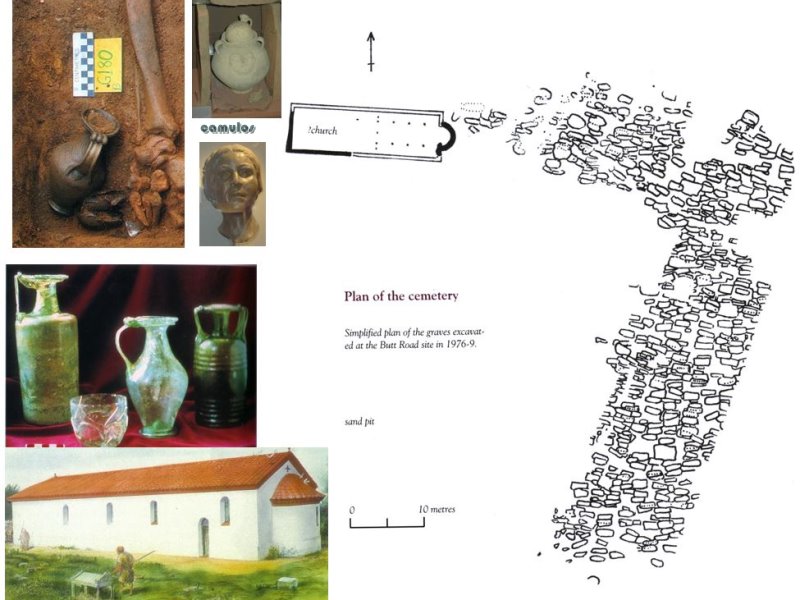
A
This picture (A) shows part of the archaeologists drawing of the graves that they uncovered during the extensive work in this area. Also examples of grave goods, indicating pre-Christian burials, to be taken with the dead into the afterlife. Some incredible glass vessels were found intact in the schist type burial plots. Also, an artist's impression of how the church might have looked.
B 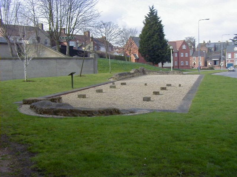
This is how the site looks today.( B)
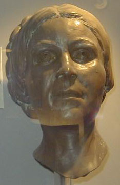
C
This is the face of Camilla (C), who was buried here, with her husband, during the Roman-British period.
She inspired a DNA project to try to identify people living in Colchester today.
7 - THE BALKERNE GATE and WEST WALL
Let us leave the church site now and head for the last part of our Colchester Roman trail. This has not been a long tour as the centuries that have passed since the Romans left Britain, around AD 411, have led to most of their structures being destroyed and built over. A lack of building materials meant that their structures were plundered and robbed out for other uses. Early recycling!
So let us cross over Southway (a road built to remove traffic congestion in our town!!!!) and walk up to Headgate (probably the later Roman period main town entrance) and turn left along Crouch Street, past the oldest pub in town, the Bull. We are still outside the walls at this point, the wall being hidden behind the shops to our right. At the end of Crouch street we turn right and, after a short while we see what is left of our Roman wall after centuries of decay and vandalism. As we wander northwards towards the Hole in the Wall pub, built on top of the Balkerne Gate - another Roman gateway, but with a difference.
Stop a moment at the few steps that serve a breach in the wall, leading to St Mary at the Walls church (now St Mary's Arts Centre). Look at the section of wall that has been broken out and you should be able to see what is left of the Roman drain that made the destruction and creation of this walkway so much easier. You will need to do the wall tour to learn more about this. Don't forget too to visit the Gosbeck's Archaeological Park here, where the Roman emperor Claudius and his legions came in AD 43 to take the surrender of eleven (allegedly) British kings.
As I said, there are not many Roman period structures left to see - apart from our walls, a few drains, the Temple of Claudius vaults and precinct wall remains and the Christian church foundations. Not forgetting, of course, the remains that have been exposed at the Roman circus.
But look around you as you do the various tours of Colchester. Roman materials everywhere! Incorporated into our Saxon/Norman/medieval churches and boundary walls, our Norman castle and various other odd locations.
Yes, the Normans very efficiently destroyed Roman Colchester - but they left us a few bits.
....and so we reach the Balkerne Gate at the crest of the hill. This is the best preserved Roman gateway in Britain - but you will need to do the wall tour to learn more of this. If you still want more, continue your Roman tour by walking the Roman walls of Colchester.
OUR ROMAN AMPHITHEATRE
(or rather, what Roman amphitheatre?)
In 2015, a dig was undertaken to find out whether a mound in the Officer's Club grounds was the site of our Roman amphitheatre. The experts all seemed to agree that Colchester MUST have had an amphitheatre. They never expected to find a circus instead, but, having found a circus, they still thought that Colchester MUST have had an amphitheatre. We have two theatres (there are only five in the whole of Britain), a circus (the only one in Britain) and numerous temples - but no amphitheatre.
They should have asked us at Camulos before they went digging around. We could have told them that Camulodunum never had an amphitheatre. Why would it? It had a circus instead; the only circus in Roman Britain. Surely that fact shouts something important doesn't it? Camulodunum was a Roman statement of how cultured the Romans were. This was a place were Roman soldiers retired and where the British people lived in peace alongside them (give or take a little petulence from the likes of Boadicea). The blood and gore of the amphitheatre had no importance or relevance here. This was a place of the arts, of cultural activities, of sporting activity. If you doubt our reasoning, tell us why the circus was built here and not in Londinium?
Let's just imagine the conversation as the entrepreneurs of the day discussed what to build. What's going to make the most money? Circus or amphitheatre? What's going to cost the most to build? Circus or amphitheatre? Why not build both and tax the Brits a bit more? Our suggestion is that a circus was chosen because it fitted nicely with the peaceable theme of Camulodunum and because there was a perfect location for it and because there were building materials available. Let's face it, an amphitheatre is a big (tall) building requiring stone rather than septaria. Colchester had no easy access to stone. An amphitheatre would have cost a fortune to build and would have been far better suited to the Londinium boys. Amphitheatres were therefore built elsewhere where proper stone was lying around or could easily be transported by water. Plus, the circus could have also been used for gladiatorial combat and athletics, just as happened in other circuses. That would fit in with the gladiatorial and chariot racing artefacts that have been found.
So sorry all you archaeologists, stick to uncovering the archaeology that we have, and put aside your foolish dreams of finding an amphitheatre.
For now, we bid you farewell. Please visit Colchester in person one day and enjoy a unique heritage experience.
Sadly, the Normans very efficiently destroyed Roman Colchester. We can only guess at what they found when William the Conqueror followed up on his victory at the Battle of Hastings in 1066 and began his reconstruction of the once proud capital of Roman Britain. A collapsed and much decayed site - an unexplained enigma and inspiration for such tales as King Arthur. The Normans bequeathed us a lot of evidence of re-used Roman materials that is to be seen today in our churches, Colchester Castle, St John's Abbey walls, etc. Less obvious though is the amount of limestone that was needed for the mortar for these new buildings. We have no idea what limestone based stonework in the form of public art, columns, architectural features, etc. was smashed to pieces to feed the fires that produced the all important limestone mortar. Who knows what fascinating inscriptions were lost by this act of reconstruction? We will never know and must, instead, rely on what snippets our archaeologists uncover as time goes by.
Where else in Britain can be claimed to have such a heritage as that which we have in Colchester?
Your tour guide has been
Sdapeze
With grateful thanks to Barrie Pearce for his delightful Roms and Bits animations and clipart.
There are separate Camulos virtual tours for:
Colchester,
Walk the Walls,
and individual web pages for the castle, the circus, etc.
return to the
Home Page
last updated
12th August
MMXX