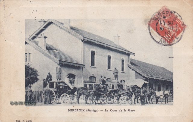
|
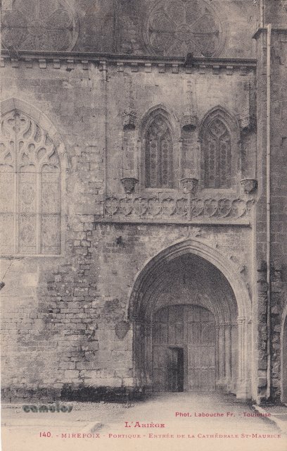
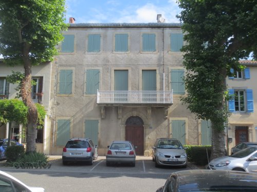
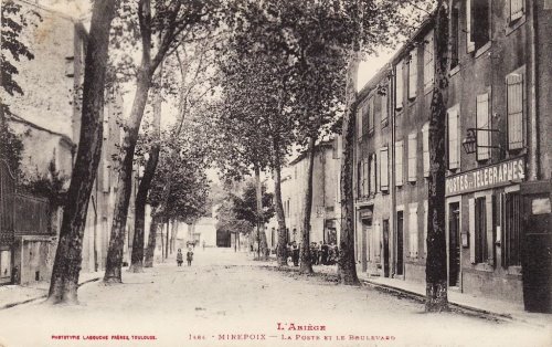
1
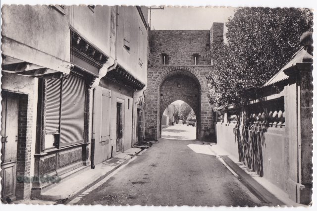
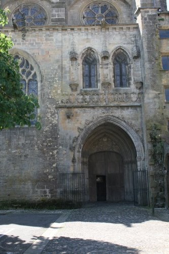 63
63
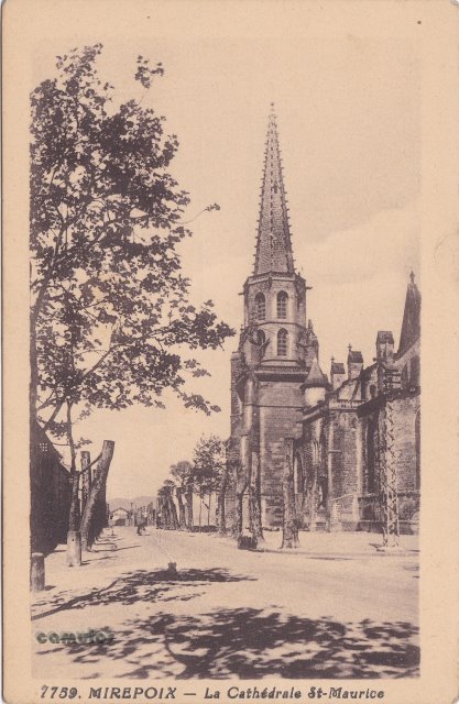
Portique-Entree
de la Cathedrale St-Maurice.
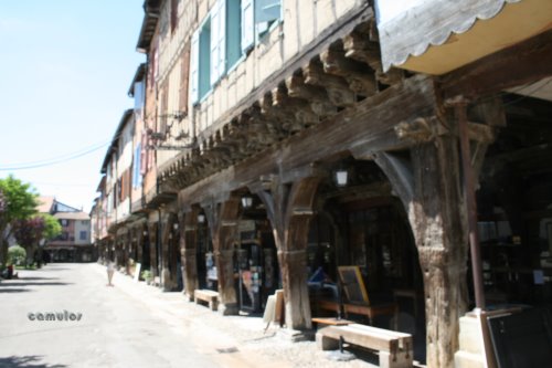
The main
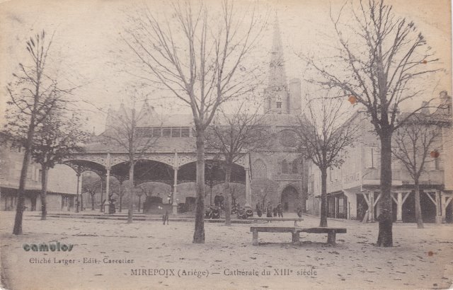
entrance door into the church. An incredible building that
looks older than it is, in parts.
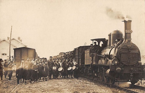
The picture to the right
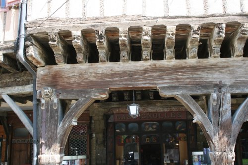
shows the former bishop's palace, which is to the right of
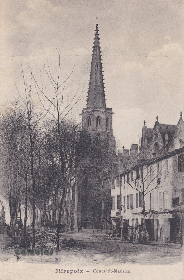
the view above.
|
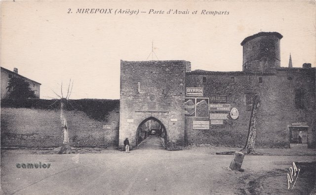
2
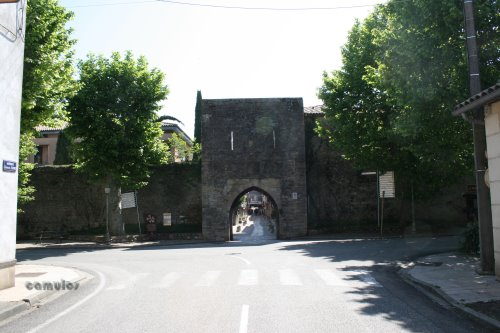 43
43
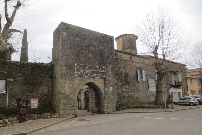
Porte d'Aval
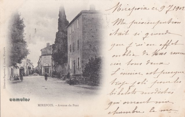
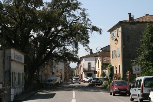
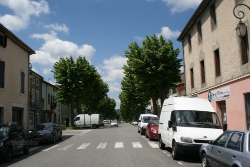
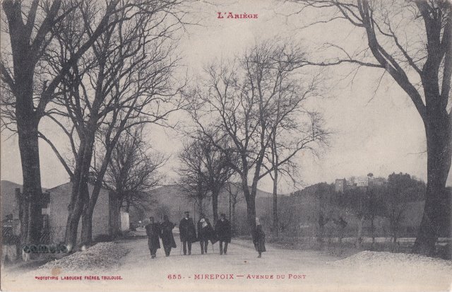
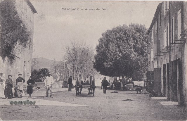
et Remparts.
Porte d'Aval, to the west of
the town.

To the right
of the main door of the church, as shown to the left, is the
former bishop's palace,
which was built onto the then cathedral, at the request of
Philippe de Lévis's. Before its construction, our
bishops lived at nearby Mazerettes, but this bishop wanted
to be closer. The carved mullions of the palace window can
still be seen from the outside, but entry inside is no
longer possible.
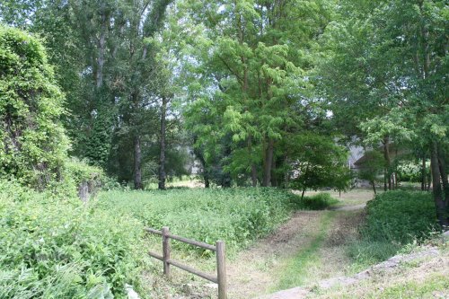
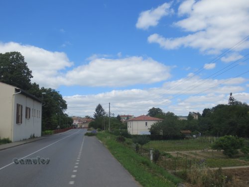
The private chapel of the
bishop, Saint Agatha's chapel, has an ornate floor from the
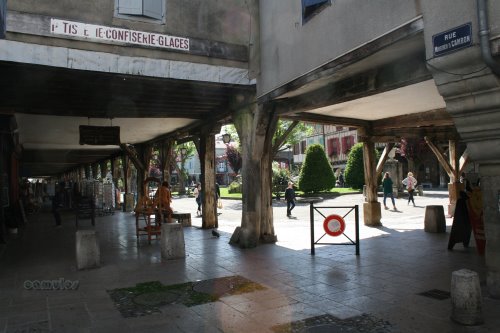
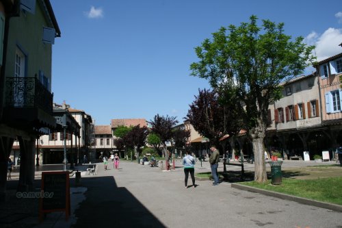
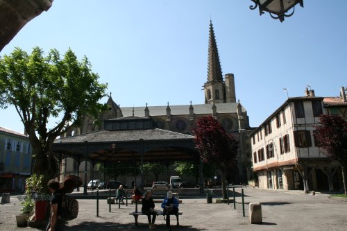
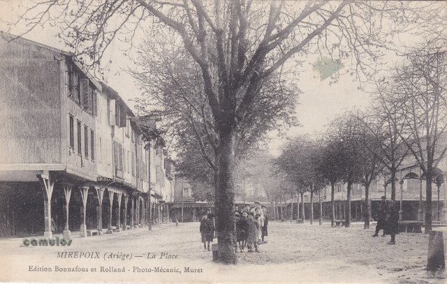
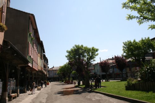
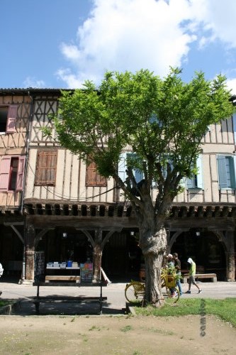
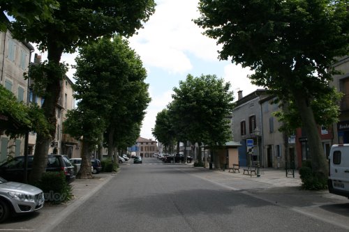
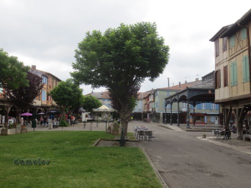
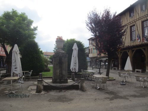
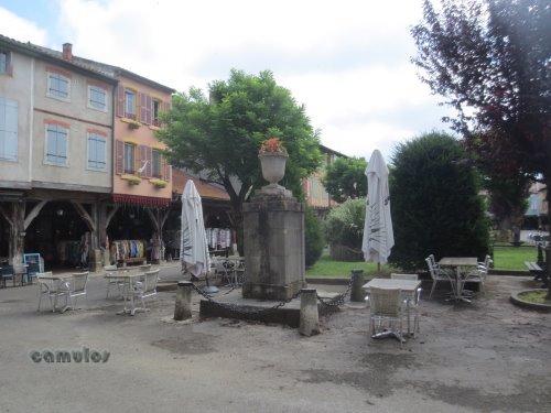
16th century which, at its centre, has a painted labyrinth,
around 60cm x 60cm, perhaps inspired by the Renaissance
interest in ancient mythology. You can see details of this
within the church, but no access is possible for the general
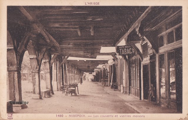
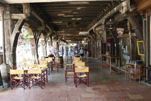
public.
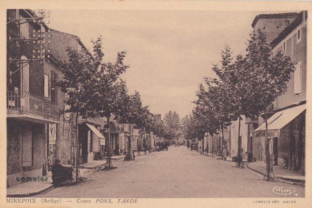
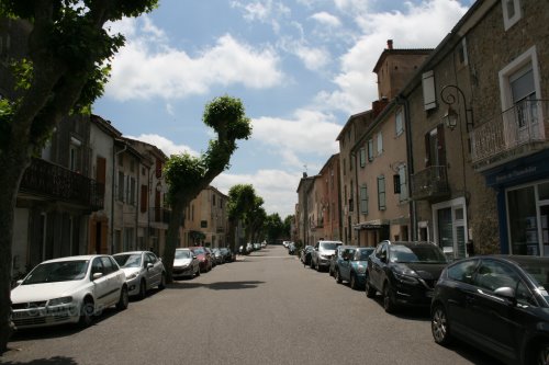
|
|
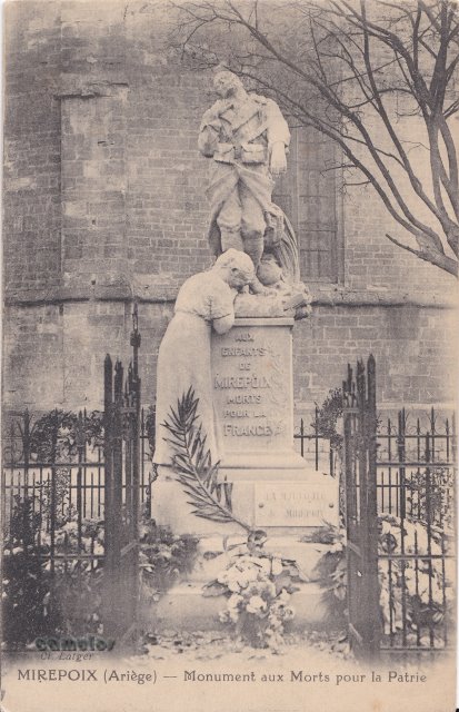
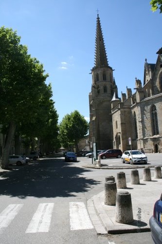
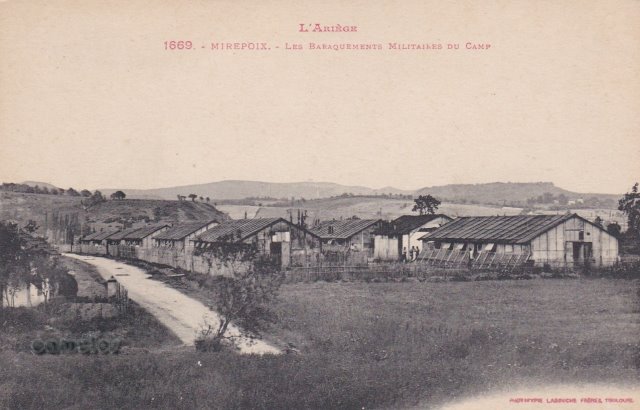
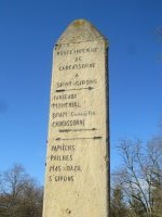
3
 64
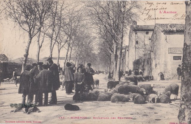
64 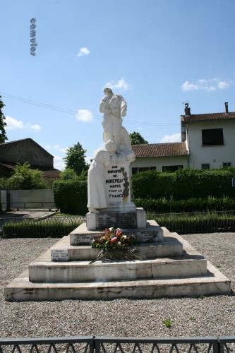 79
79
Monuments
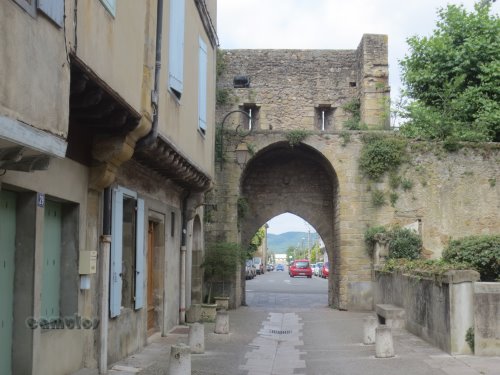
aux Morts pour la Patrie.
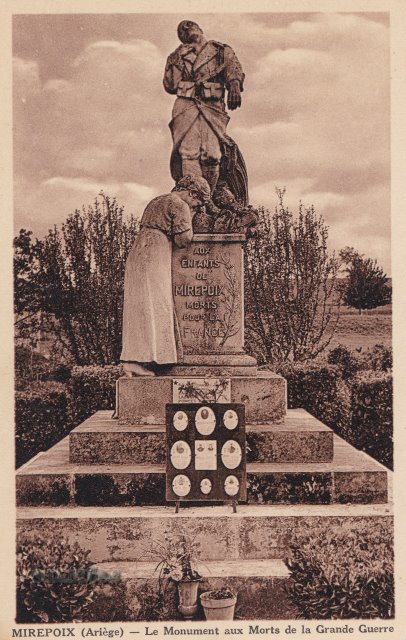
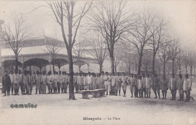
A relocation of the First
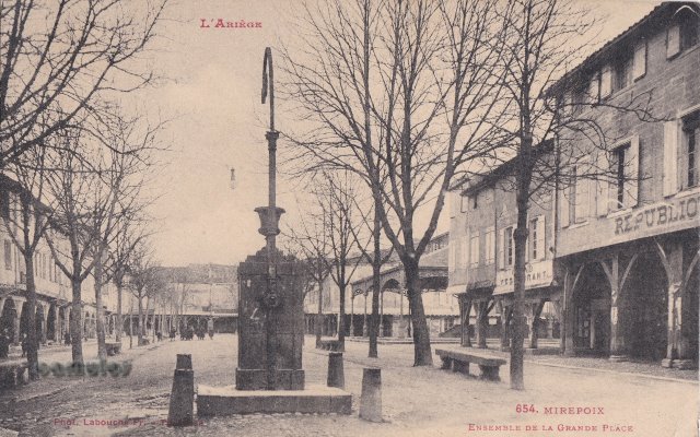
World War memorial, was made at some time. It commemorates
'Les Enfants de Mirepoix, morts pour La France'. A secular
remembrance ceremony is held each 11th November.
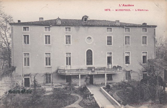
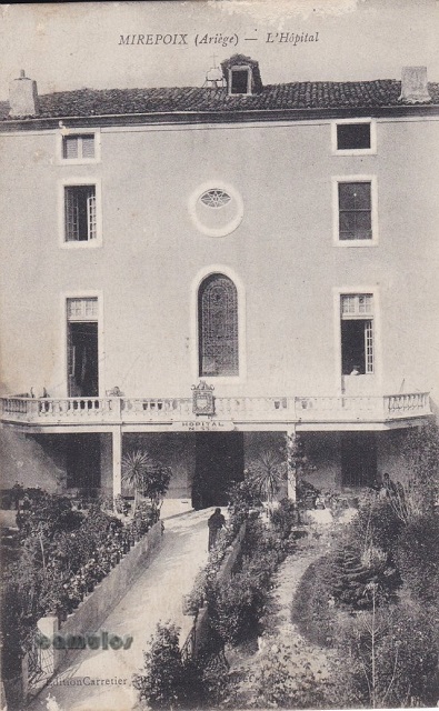
https://www.youtube.com/watch?v=oNbBDZYvnXI&t=122s
|
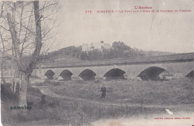
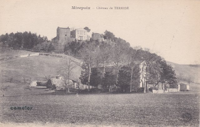
4
 00
00
Le Pont sur
l'Hers et le Chateau de Terride.
Trop d'arbres ! Too many
trees today to get a comparative photograph.
The seven arched, 206 metre
long bridge that spans the River Hers is the work of
architect Jean-Rodolphe Perronet (1708–1794). It was
constructed between 1776 and 1791. Among his other
achievements are the Pont de la Concorde in Paris
(constructed 1787–1791) and the bridge of
Nantes.
Note the Chateau de Terride
in the background of the postcard image.
|
|
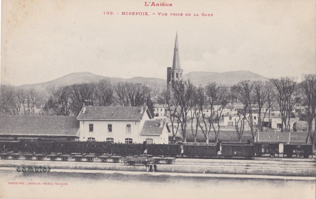
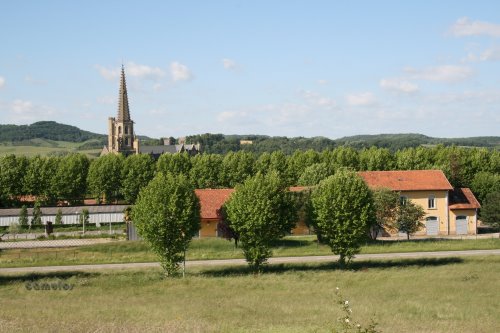
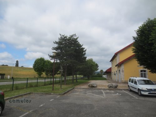
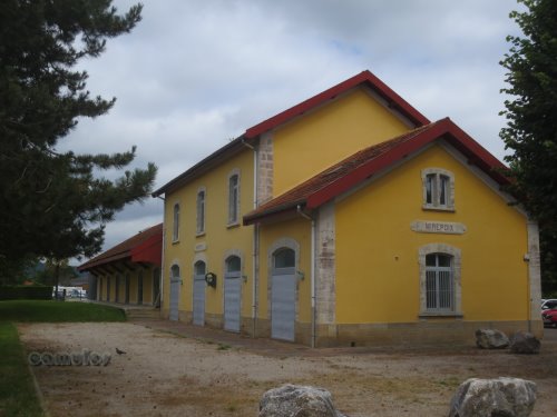
5
 86
86
Vue Prise de
la Gare
Mirepoix once had a railway
system, now all gone, apart from most of the railway
buildings, which have survived but have been converted for a
different use. Thankfully we have these old pictures to show
us how things once were. When was the station closed? Does
anybody know?
|
6
 48
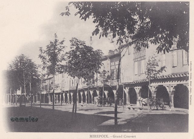
48
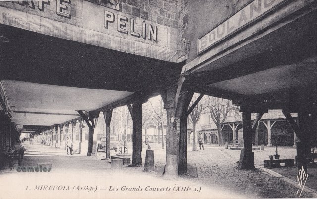
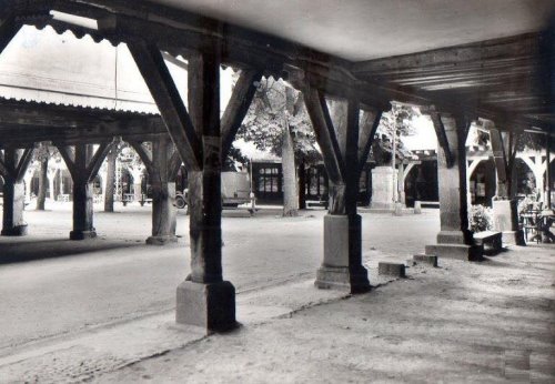
Les Grands
Couverts
Mirepoix has one of the
finest surviving arcaded market squares in France. The
square is surrounded by buildings that date from the
thirteenth to the fifteenth centuries.
|
|
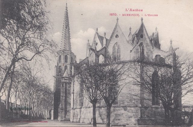
7
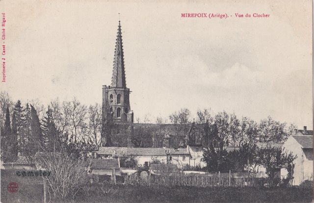
Vue de
Clocher
A view of the cathedral bell
tower. A modern day comparative photograph is not possible,
due to trees.
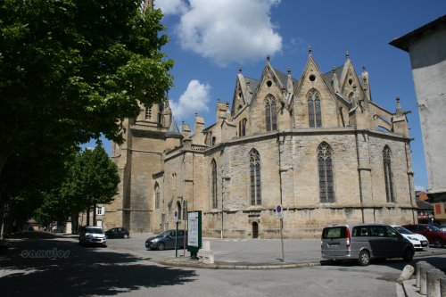
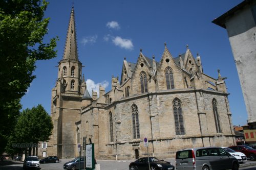
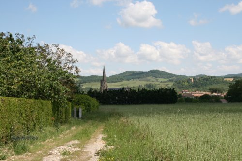
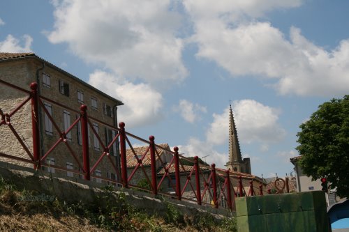
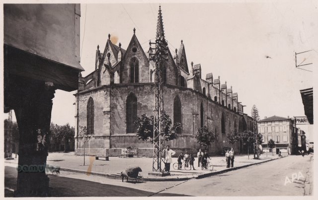
Mirepoix Cathedral
(Cathédrale Saint-Maurice de Mirepoix), is a former
Roman Catholic cathedral and is now a national monument of
France. It was the seat of the bishopric of Mirepoix, until
it suppression in 1801. It is now simply (officially) a
church, once again.
Built in what is known as
the southern gothic style, it became a scheduled ancient
monument a century ago. It has a single span nave, with no
supporting columns between, of 22 metres; the widest in
France, and the second widest in Europe.
The foundation stone was
laid in 1298, and the church was stablished as a cathedral
in the 14th century. Bishop Philippe de Lévis carried
out major works done in the 16th century which included the
building of the bell-tower (clocher) and steeple. The
building as we see it today was completed in the late 19th
century.
|
8
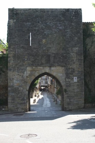 45
45
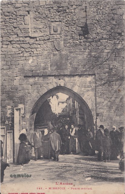
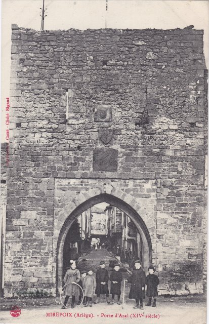
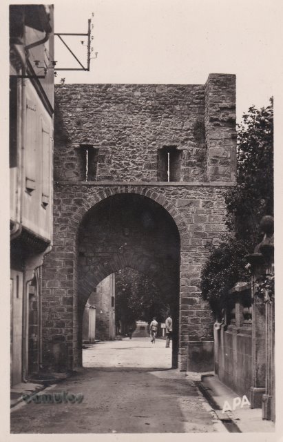
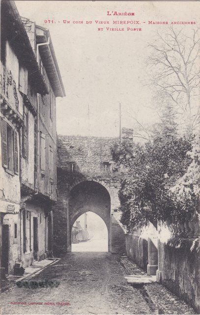
La Porte
d'Aval
The Porte d'Aval (tail-gate
in English) is the only remains that are visible of the 14th
century fortified walls that enclosed the city to defend it
from outside attacks. Above the gate, three stones can be
seen which, so we are told, bear marks of the French
Revolution in 1789 which erased the original armorial
bearings of the Lévis family, of the town and of the
chapter, in 1790. The gate dates from 1372.
|
|
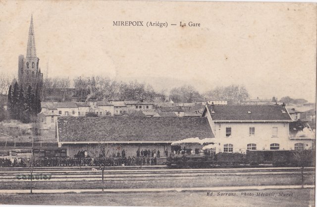
9
 15
15
La
Gare
The railway station with a
steam train and carriages passing through. Many people lined
up along the line.
|
10
 09
09
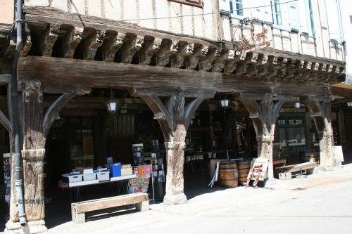
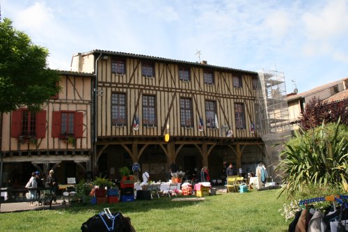
The House of Consuls. Les
Couverts. Dating from around 1500 it has a massive single
span lintel of 12 metres in length, and equally impressive
supporting columns. The building once housed the town
magistrates, with the present day Town Hall (la mairie)
building only dating from the 17th century. This has to be
the largest and most impressive house in the square. Its
carved decorations are a joy to behold, comprising 103
intricately carved heads, characters, animals, birds and
beasts, obscene bodies, sad faces, etc, all typical medieval
images.
|
|

11
 66
66
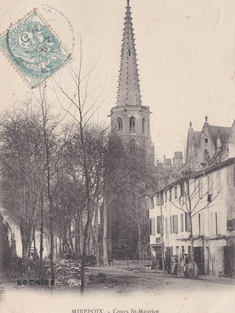
Eglise et
Cours St-Maurice
Note the location of the war
memorial, since moved to another
location.
|
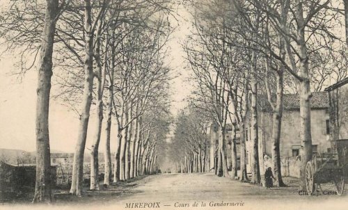
12
 13
13
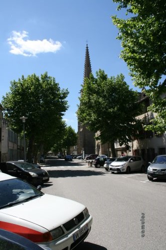
Cours
St-Maurice.
|
|
13
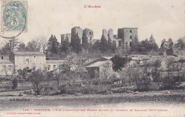
Vue
d'ensemble des Belles Ruines du Chateau de Lagarde (XIII
Siècle)
This is the castle ruins of
Lagarde, even more collapsed now than they were in the
postcard image.
Not Mirepoix, but not far
away.
|
14
Porte d'Aval
(XIX siècle)
|
|
15
 54
54
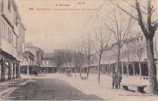
La Grande
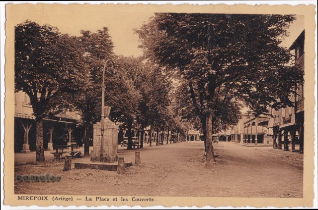
Place des Couverts
The plan for the new town
was that of the 'bastides', a large central square, making
social and economic life easier (especially for fairs and
markets), and the streets laid out in a chessboard pattern.
Shopping stalls could then be held on the ground floor in
the houses around the square, sheltered by a covered gallery
set on massive oak pillars, as you see it today.
|
16
 06
06
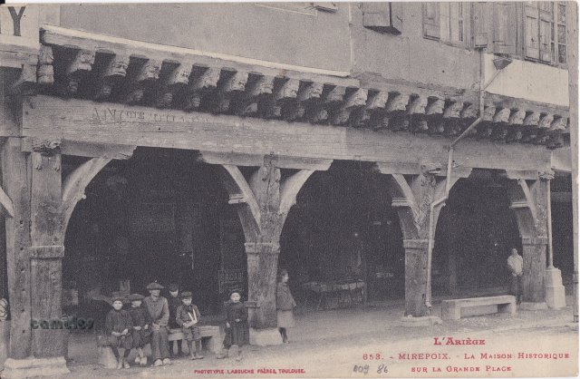
La Maison
Historique sur la Grande Place.
The two
stone benches are still there, still much used. The massive
18 metre oak lintel and its equally massive supporting
columns of Consul House in clear view.
|
|
17
 40
40
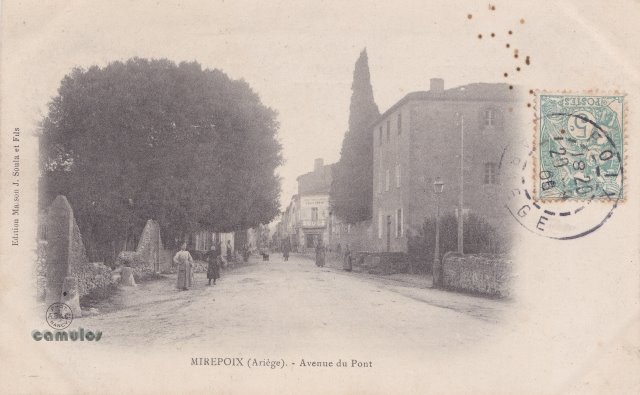
Avenue de
Pont.
The
Chene
Vert much different now,
by comparison.
The holm oak is listed as an
ancient monument. Perhaps the last surviving tree of the
Plene
Fages forest. After the
floor in 1289 that destroyed the old city, trees from that
forest were used to build the houses of the new town of
Mirepoix, so many oak pillars in evidence today, holding up
Les Couverts. Let us hope it thrives for many more years to
come.
|
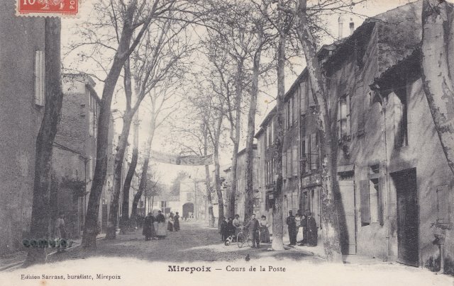
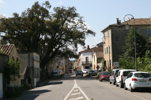
18
 77
77
Cours de la
Poste
To the left of the modern
day photograph is what was known as Malroc's House, a
beautiful 18th century town-house that once belonged to
Guilaume
Malroc de Lafage, who
was a consul of the city and then its mayor in 1791. Today
it is known as Le Relais and is one of the town's best
restaurants and hotels.
|
|
19
 70
70
.jpg)
|
20
 41
41
Near to the
seven arched bridge, towards the town, there is a much
smaller bridge which crosses a canal, known as the
Béal,
constructed to bring water to the city's mills and
industries of that time. Smaller bridges, known as
pontilles,
enable you, in places, to cross the canal by foot. How
did the water get there?
Alongside the canal is a
big oak tree, called simply the
Chêne
Vert, said to be
many centuries old. In the space of the 100 years or so
between our two pictures here, the great tree has become
less compact; seemingly the only survivor from a time
when oak trees would have been in abundance here, the
source of wood for constructing the buildings of
Mirepoix.
|
|
21
 99
99
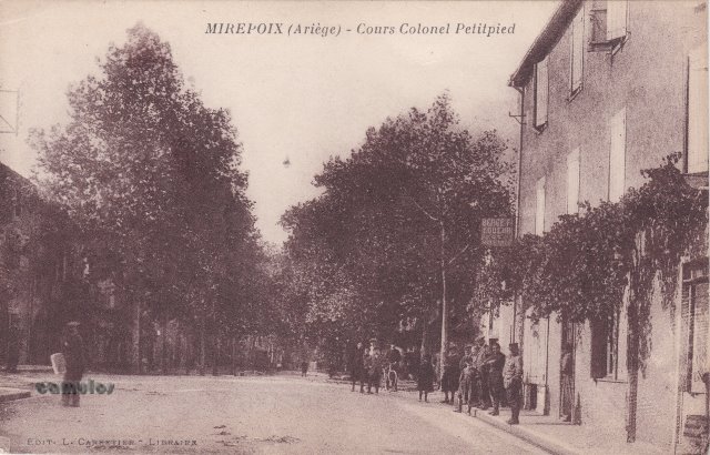
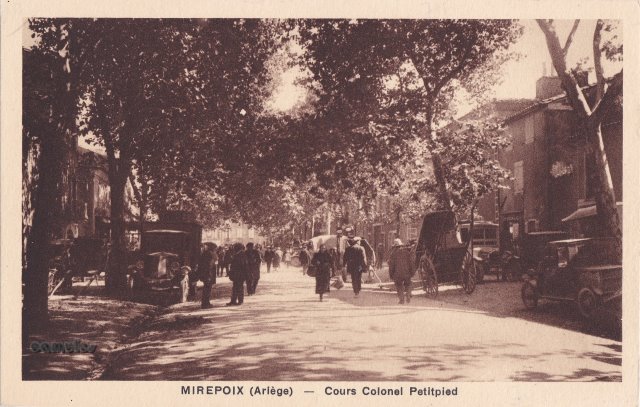
Cours Colonel
Petipied.
This road was named in
honour of Colonel
Jules Petitpied,
1815-1874, a military hero, born in this road in Mirepoix.
He is remembered for his impressive military career as
colonel of an artillery regiment and for saving the colours
(the flag) from falling into Prussian hands. Those colours
were hidden by the colonel under difficult conditions and
later rescued by the colonel's wife. It is an interesting
story of valour and service. A true
'enfant
de Mirepoix'.
|
22
 98
98
Avenue du
Pont
|
|
23
 59
59
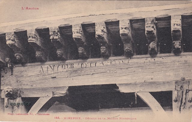
Détails
de la Maison Historique.
Details of some of the
carved faces and assorted subjects that adorn the building
known today as the Consul building in the old market
square.
|
24
Chateau de
Terride
Modern day comparative
photograph, not possible. Too many trees! However, it stands
out clearly on the hill from many viewing points.
The first mention that we
know of for the ancient Château de Terride was in 960.
It was captured (together with Mirepoix) by Simon de
Montfort in 1209. What it was known as, at that time, is not
known, but we know that it was 'Terride' in the 16th
century.
Simon
de Montfort, 5th Earl of Leicester in England
(c.1175 – 25 June 1218), known as Simon IV (or
V) de Montfort and, as Simon de Montfort the Elder,
was a French nobleman and soldier who took part in
the Fourth Crusade (1202–1204). He died at the
Siege of Toulouse in 1218. He was lord of
Montfort-l'Amaury in France and the Earl of
Leicester in England.
|
|
25
 12
12
Cathédrale
St-Maurice.
One of many views of this
beautiful building.
|

26
 81
81
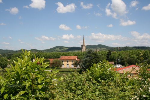
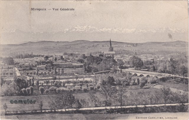
Vue Generale.
A general view from high
ground to the south of the town, with the railway line in
the middle ground, the cathedral with its spire, and the
Chateau
de Terride in the
distance, on the right of the picture. The modern day view
is very different, with trees blocking the view of the
town.
|
|
27
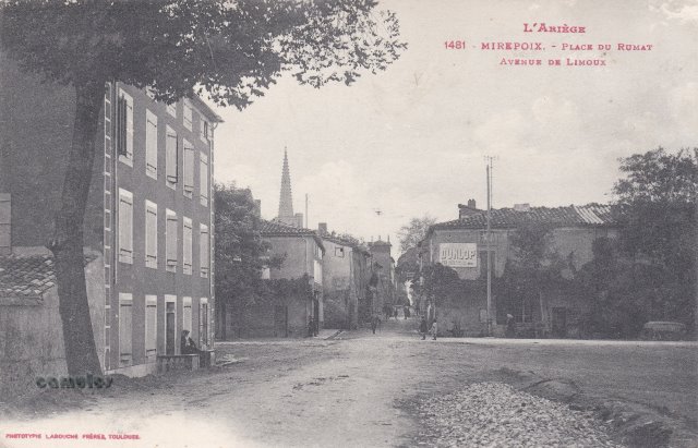
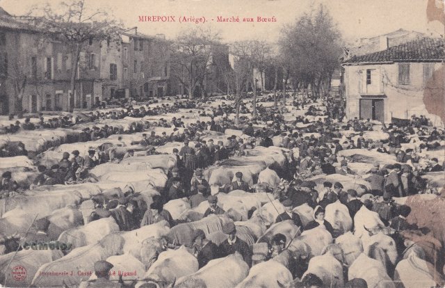
 92
92
Place du
Rumat - Avenue de Limoux
We couldn't get an exact
position to take this modern day photograph, as a bridge had
been built in the intervening years. This is the best that
we could get. Behind us in this picture is the river. In
front of us was where the livestock markets were held.
Keeping the city centre clear (outside the walls) of the
livestock would have been a good move (imagine the smell),
whilst also providing nearby drinking water for the
animals.
|
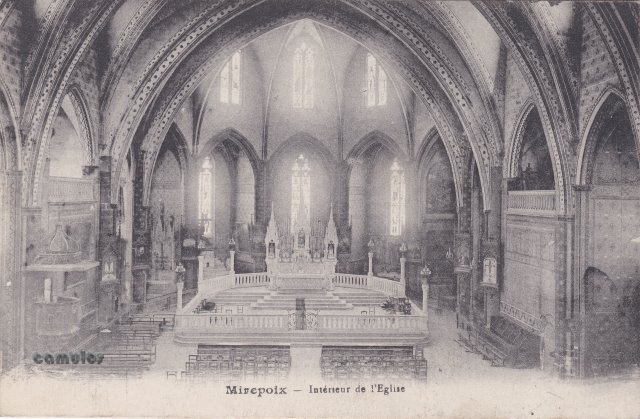
28
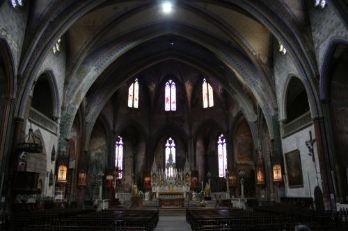 74
74
Intérieur
de l'Eglise. The
interior of the church.
The cathedral of St-Maurice
has the second widest Gothic arch in Europe (after Girona in
Catalonia). The foundation stone was laid by
Jean de
Lévis on the 6th
May 1298. Construction continued, with many interruptions,
over the next six centuries. The cathedral was restored in
1858 and 1859 by Prosper
Mérimée
and Eugène
Viollet-le-Duc.
|
|
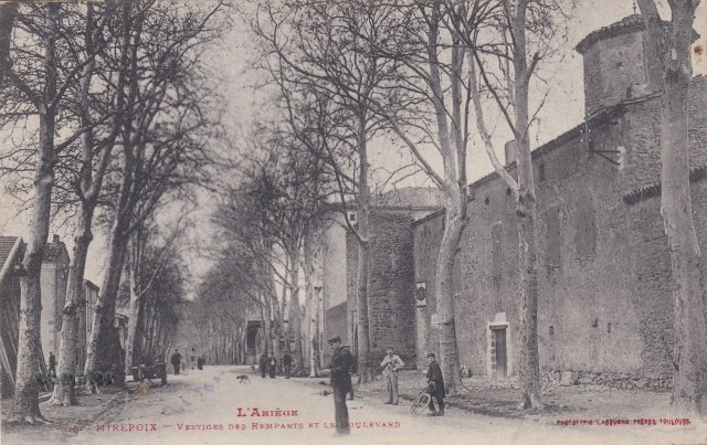
29
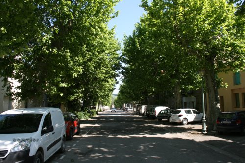 42
42
Vestiges des
Remparts et le Boulevard.
Trop d'arbres !
|
30
 50
50
Cathédrale
du XIII siécle.
|
|
31
 52
52
La
Place
The central square is
situated in the heart of the town and is surrounded by
covered galleries resting on wooden pillars. It remains the
administration and business centre of the town, as well as
being a place for dining 'al fresco', socialising and
entertainment.
The area used to be twice as
large when the town was constructed, but it was reduced to
its present size in the 15th century when the 'couverts du
Midy' (the southern galleries) were built.
Many events and
entertainment activities take place here, all year round,
with the traditional weekly market being held on Monday
mornings.
The tourist office will
provide you with up to date information about events that
are happening.
https://www.tourisme-mirepoix.com/
|

32
Our oldest postcard, dated
1901. Indeed, the sender remarks on the fact. Picture
postcards like this were introduced around this time due to
their lower cost of postage and ease of use. The fact that
the facteur
knew your business, was a secondary concern.
 60
60
Maison
historique du XVI siecle.
The medieval
'Maison
des Consuls' (house of
the council) has its ceiling beams carved with around 100
images of animals, monsters, objects and caricatures of
medieval personalities, professions and social groups. What
looks to be one of the king, has a corresponding vulgar
carving of a backside/bottom/bum to the rear. A medieval
carver's little joke perhaps, or done at the behest of the
consul? We will never know. Sadly the external carvings have
suffered from the effects of the weather over the centuries.
The internal ones not so much.
The building has many other
interesting features, including a fine example of a barred
window, from a time when glass was expensive and windows
took a different form.
|
|
33 (see
also 57)
 19
19
The cattle market at Rumat.
An incredible sight (and smell, no doubt). Would this have
been a normal market day? The nearby river would have served
to water the beasts. Today, the area gives no clue to its
earlier use, the wide section presumably designed that way,
on purpose, for livestock market use.
|
34
 32
32
Rue Colonel
Petitpied.
Looking East. Full of hustle
and bustle 100 years ago. Full of cars today.
With the colonel's place of
birth pictured below.
 52
52
|
|
35
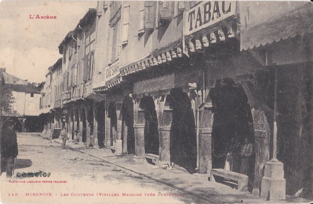
 53
53
Les couverts
et vieilles maisons.
'Les couverts' are much used
today for restaurant tables and displays. Originally they
would have afforded undercover space for the market traders,
during times of wet weather. The stone seats that we see
regularly in the old postcards are still in use today,
relics of a bygone age.
|
36
 40
40
Cours Pons,
Tande
Marie-Louise
Escholier
(1876–1956, née Marie-Louise
Pons-Tandy), was born in
Mirepoix and became a writer. She was the co-author, with
her husband Raymond
Escholier, of the novel
Cantegril. She and her husband are buried in the town's
cemetery.
|
|
37
 36
36
Rue Porte
d'Amont
Looking west, this is where
one of the main entrances to the fortified city once stood,
sadly now all gone. Presumably it was constructed in a
similar style to the Porte
d'Aval on the opposite
side of the town. Now a busy thoroughfare giving access to
the medieval centre.
|
38
 57
57
Halle aux
grains et l'Eglise.
The market hall was built in
the 19th century, in the 'Baltard' style, a 19th century
name of the French architect who was famous for using cast
iron in his designs. It's main function would have been for
the trade in wheat and barley, and other grain types. The
hall is often used today for the many festival activities
that Mirepoix is renowned for, particularly for its music
performance stages.
Two of the 17th to 18th
century grain measures can be seen outside the tourist
office at the town hall (Le
Mairie). They used to be
sited in the old market hall that was removed to make way
for this new hall. The measure had a capacity of 20 litres
(double
décalitre), and
was designed with a sloping base to enable the grain to
flow. The exact measure was closely controlled to ensure
fair trade between buyer and seller.
|
|
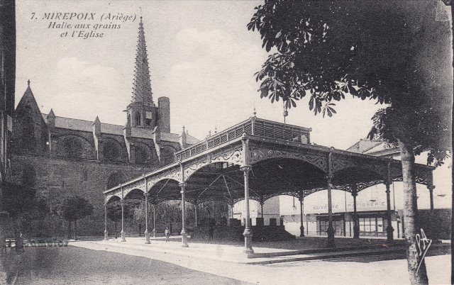
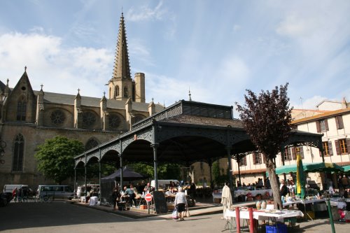
39
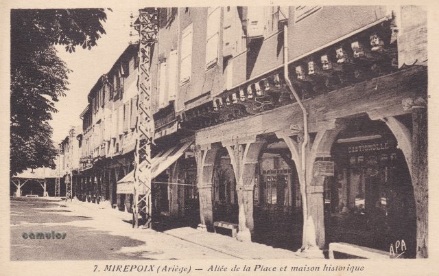
Allée
de la Place et maison
historique.
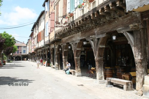 44
44
|
40
Boulevard
des Remparts
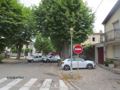 95
95
Was this where the sheep
market used to be?
|
41
Grand
Couvert
 98
98
Single back card, so dating
from around 1901. Unused.
|
42
|
|
43
Porte
d'Aval
A recent postcard, compared
with others here, unused, perhaps 1960s.
 93
93
The
last surviving medieval gateway, from inside the city. Close
inspection of the gate shows the slots above and to the
sides, where the 'portcullis' would have been used. Also
evidence of hinge points for the doors.
|

44
La
Place
Another single back card, so
dating from around 1901. Unused.
 00
00
|
|
45
Ensemble de
la Grand Place
 90
90
|
46
La Place et
les Couverts
 91
91
|
|
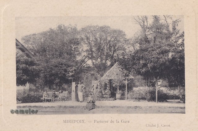
47
Parterre de
la Gare.
A garden at the railway
station, no doubt created by the station master during the
time that he had spare between train arrivals. All now gone,
of course. The postcard is post marked December
1915.
|
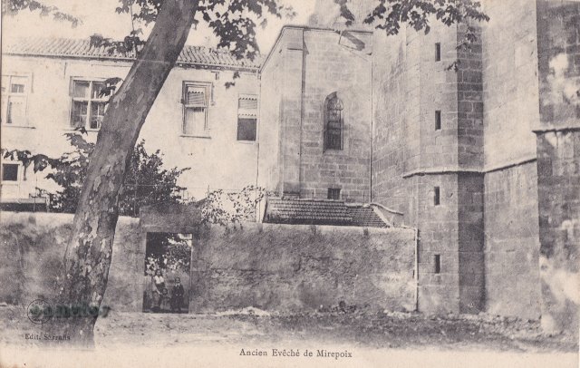
48
Ancien
Eveche de Mirepoix
 17
17
A part of the Bishop's
Palace. Behind the door is a small courtyard which leads to
a beautiful chapel. The postcard is post marked
1917.
|
|
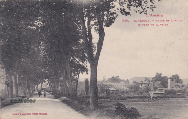
49
Route de
Limoux Entrée de la Ville
 16
16
The trees have all gone now,
and a new bridge added. The tower to the right is still
there, partially hidden by trees.
|
50
55
|
|
51
Cathédrale
St-Maurice
The Church of St Maurice.
This postcard was sent in April 1952. Note the ugly
telegraph posts that are to be seen in other postcards here.
Note the absence of motor cars too.
|
52
Avenue du
Pont
|
|
53
Le Monument
aux Morts de la Grande Guerre
The war memorial, presumably
a short time after it had been re-located. A very different
view of it is seen today with a large hedge and housing
behind the monument and, of course, more inscriptions from
later conflicts.
|
54
Vue
Générale
A view, probably from the
Chateau Terride, looking down on the town and with the
snow-capped mountains in the distance. The card was posted
in 1926.
|
|
55 see 51
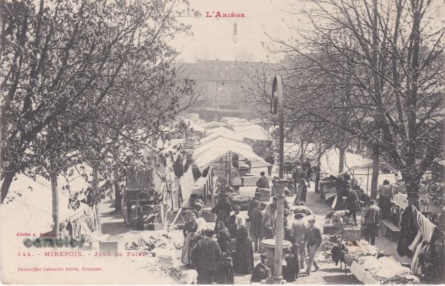
56
Jour de
Foire
|
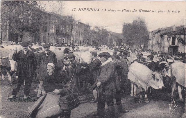
57
Place du
Rumat un jour de foire
|
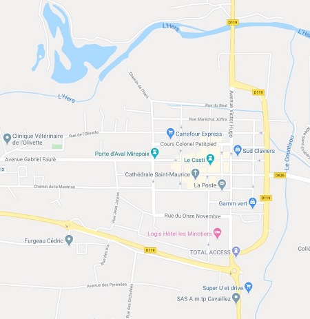
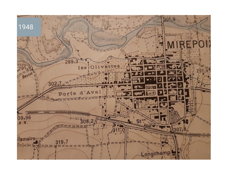
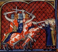
In the 11th century, a village called Mirepoix used to lie at the foot of the hill where the feudal castle (known today as the Chateau de Terride) still stands, to the west of the River Hers. Before the crusade, that village was a place of paramount importance, as we know that the cathar deacon Guillabert de Castres visited several times. In 1206, a massive gathering of over 600 cathars was held in Mirepoix.
Mirepoix took advantage of its strategic situation; being halfway between Foix and Carcassonne, it became a privileged trade centre, until the tragic flood of 1289. That flood was to destroy Mirepoix and several villages in the Hers valley. Guy III de Lévis then joined the great movement of town planning in France and had his new town built on the left bank, to the south of the river.
 9546
9546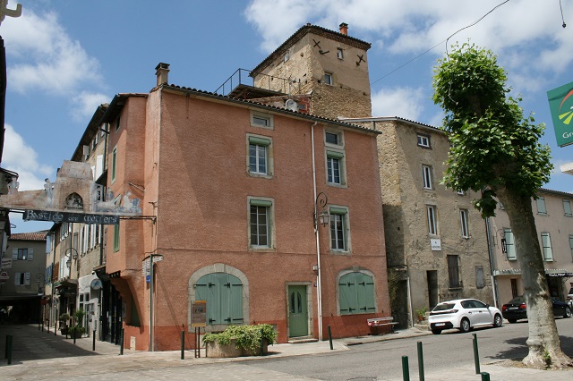 2437
2437
 97
97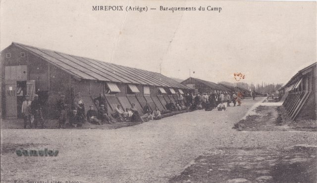
 64
64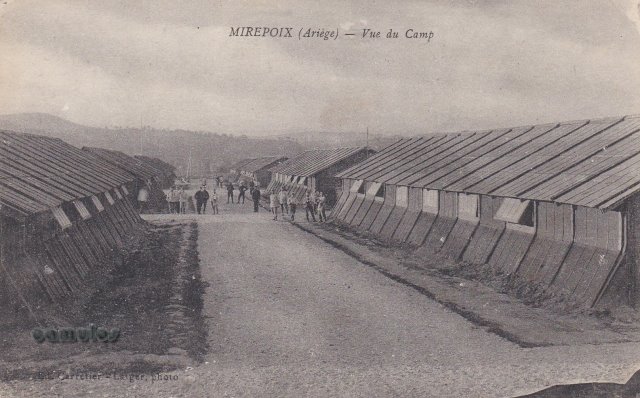 77
77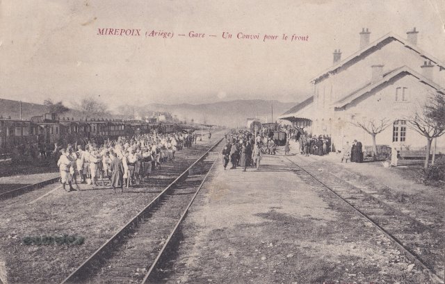
 73
73
 63
63
 75
75 65
65 66
66 67
67 74
74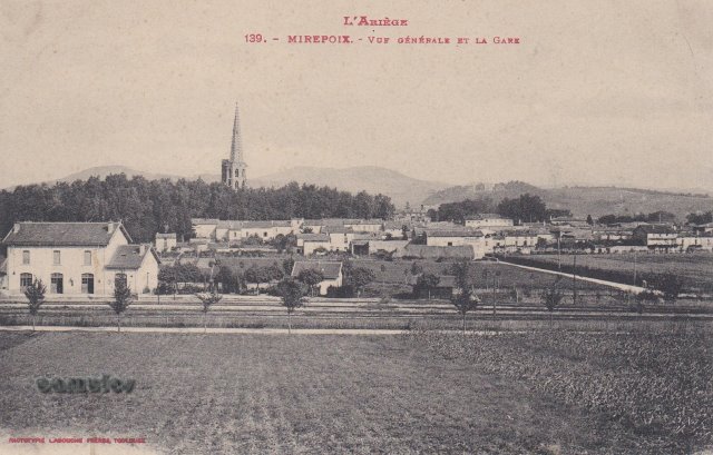 68
68 69
69 70
70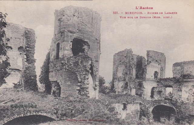 71
71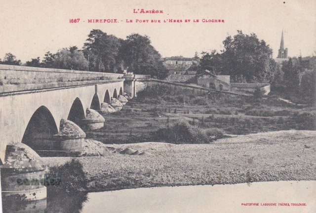 72
72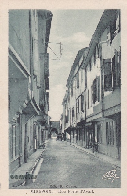 76
76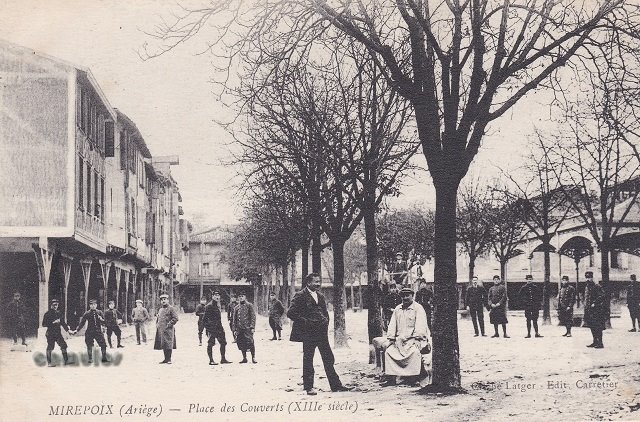 78
78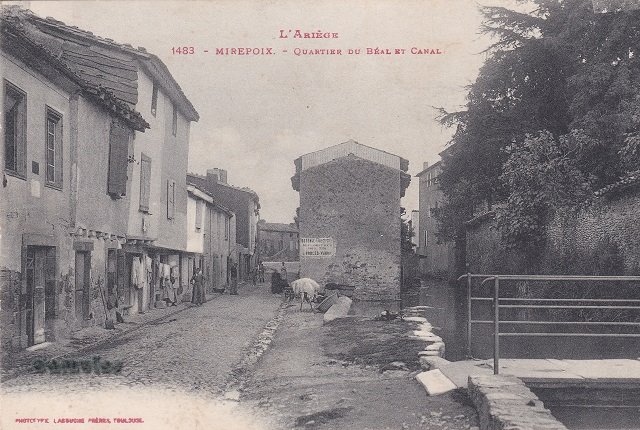 79
79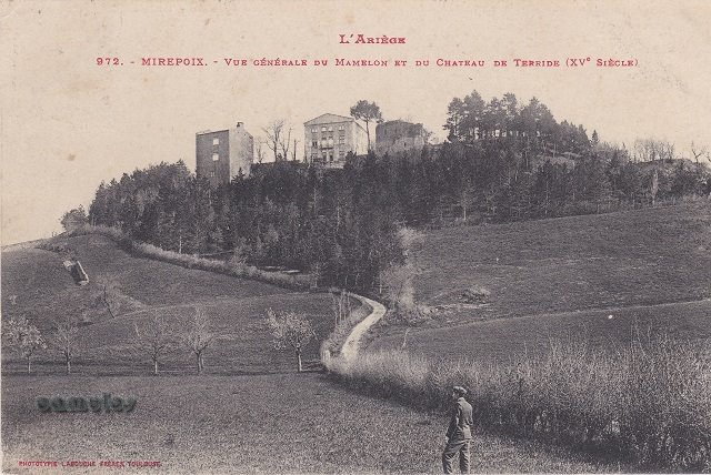 80
80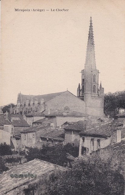 81
81
 1
1 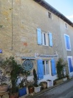 2
2 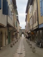 3
3  4
4 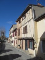 5
5  6
6 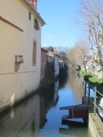 7
7  8
8  9
9 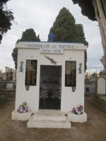 10
10 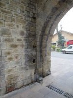 11
11 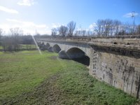 12
12  13
13  14
14  15
15 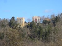 16
16 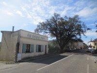 17
17 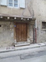 18
18  19
19 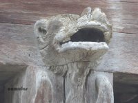 20
20 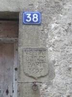 21
21 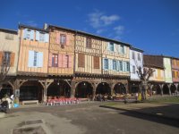 22
22 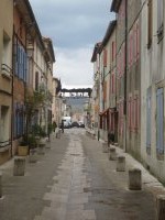 23
23 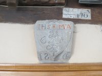 24
24 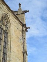 25
25 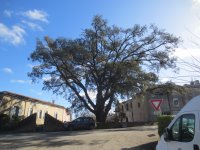 26
26  27
27  28
28 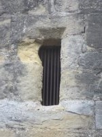 29
29 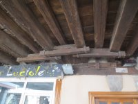 30
30 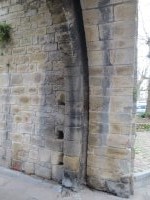 31
31  32
32 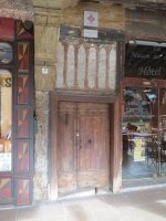 33
33 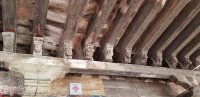 34
34 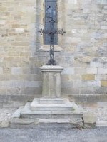 35
35  36
36 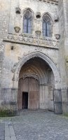 37
37  38
38  39
39  40
40 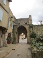 41
41 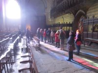 42
42 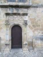 43
43  44
44  45
45 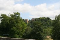 46
46 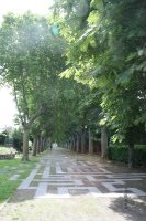 47
47  48
48 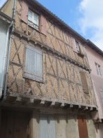 49
49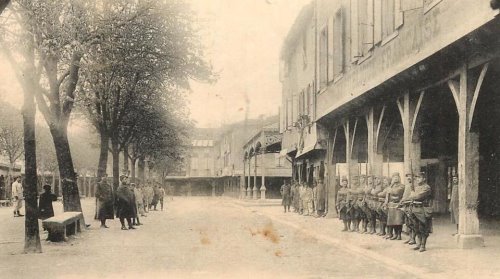
s.jpg)