PART
![]()
(for Extra and for End)
of your

GUIDED
TOUR
OF
COLCHESTER
PART
![]()
(for Extra and for End)
of your
GUIDED
TOUR
OF
COLCHESTER
Welcome to the final part of this virtual guided tour.
We hope that you have enjoyed the first four parts, which are based on the standard town guide walking tour.
This final page gives places of interest that are not included within the standard walking tour. Here they are:
The Bandstand in the Castle Park
The unwelcome visit by Queen Boadicea of the Iceni tribe, around the year AD 60, has led to her becoming a folk legend of particular relevance to Colchester. So much so that a modern sculpture of her was commissioned and now stands proudly at the centre of a roundabout near North Station. Like it or loathe it (we love it!), it is a formidable and evocative image of this warrior queen who wreaked such devastation on this town all those years ago.
1 
![]()
The Siege of Colchester of 1648, also had a devastating effect on our town. Many of our finest buildings were damaged or destroyed by cannon balls from Roundhead (Parliamentarian) fire. Indeed, it was only special pleading which prevented our Roman walls from being pulled down, after the conflict, as Parliament wanted an assurance that Colchester would never again be able to defy government forces so effectively. The town was fined very heavily for its defiance which led to a considerable decline in its prosperity and the well being of its populace.
2 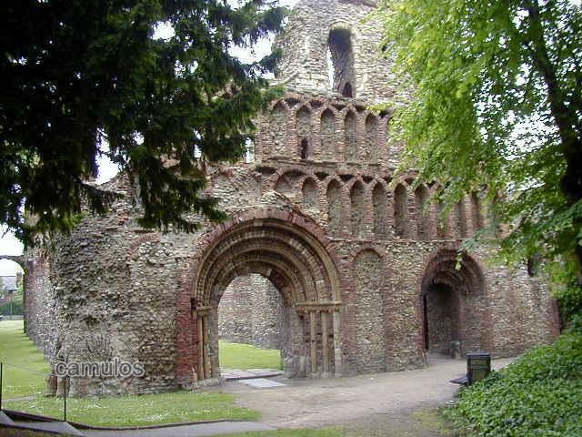
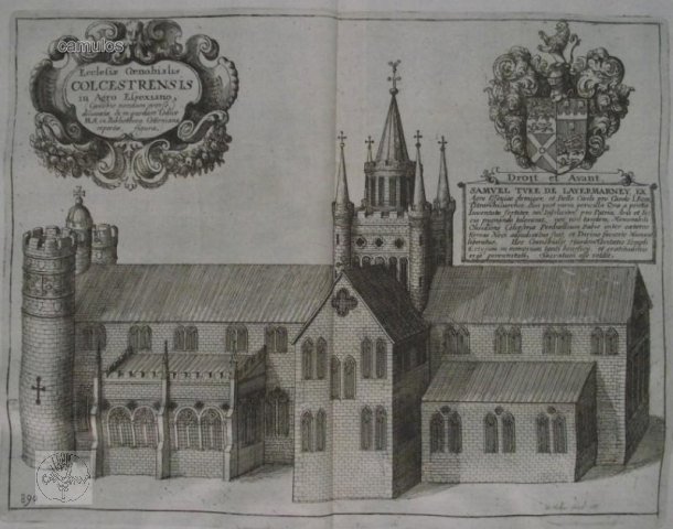
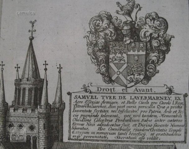
The dissolution of the monasteries under King Henry VIII in the 16th century, led to our St Botolph's Priory falling into decline - but it was the cannon ball of the 1648 siege of Colchester that reduced much of it to the sorry state that it is in now. It must have been a wonderful building in its day.
St Botolph's Priory was the first Augustinian priory built in this country, having authority over all other houses of the order in this country. It was founded between 1093 and 1100 and had thirteen inmates, comprising one prior and twelve canons, typifying Christ and his disciples. It was never a wealthy endowment, despite its seniority amongst Augustinian houses.
3 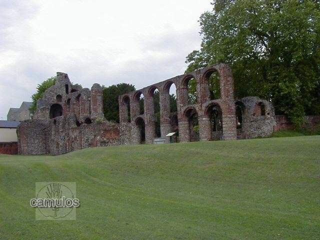
![]()
Discounting the presence of barracks erected by the Romans shortly after they conquered Britain, Colchester has long been known as a garrison town. The first official barracks were constructed during the Napoleonic wars of the late 18th century. The Crimean War of the 1860s brought further barracks construction, later to be replaced by the brick built barracks of the Cavalry, Infantry and Artillery barracks of the 1870s, followed by Hyderabad and Meanee in the 1890s. The Infantry and Cavalry barracks stand today as a reminder of past times and have preservation orders placed on some of them because of their heritage importance. At the height of war, the Cavalry Barracks housed 3000 men and 5000 horses, some of the barrack blocks constructed so that a cavalryman slept in a room above his horse's stable.
Today, Colchester proudly hosts the Parachute Regiment, who have recently made Colchester their regimental headquarters.
Colchester also has a place known by many past soldiers as 'The Glasshouse' (named after the military prison at Aldershot, which had a glass roof) building, the army military corrective centre (MCTC) - the military jail. It was the abolition of capital punishment in the 1860s, when a soldier could be flogged until close to death, that brought about the need for jails for an alternative punishment. Previously the punishment fitted the crime and that was the end of it.
Whilst all evidence of the Napoleonic barracks to the east of the town have been lost, the area that surrounds what we know as Abbey Fields today, has undergone much change since the army sold it all off for housing development around 2004. Many of the old Victorian, and later, military building were lost to to the demolition men, but many were saved and some even converted for civilian use. Lost were the parade grounds of the individual barracks, new houses constructed in their place. We think that the developers have done a good job of it, although there is still more work to do.
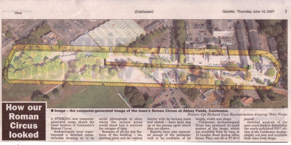
One huge discovery was made in 2004, that of the presence of a 2nd century Roman circus. That subject is dealt with under Colchester's Roman Circus within this web site, although full details of the current situation requires you to leave Camulos and visit www.romancircus.co.uk.
The area was quite run down after the army left for their new Merville Barracks, modern facilities for a modern British Army, and all that. That is why some of the following pictures taken at the Cavalry Barracks a few years ago show signs of neglect. The area looks very different today and we hope to show more recent images in the near future. Many of these are protected buildings so they should survive for many years to come as unique examples of Britain's military heritage.
4 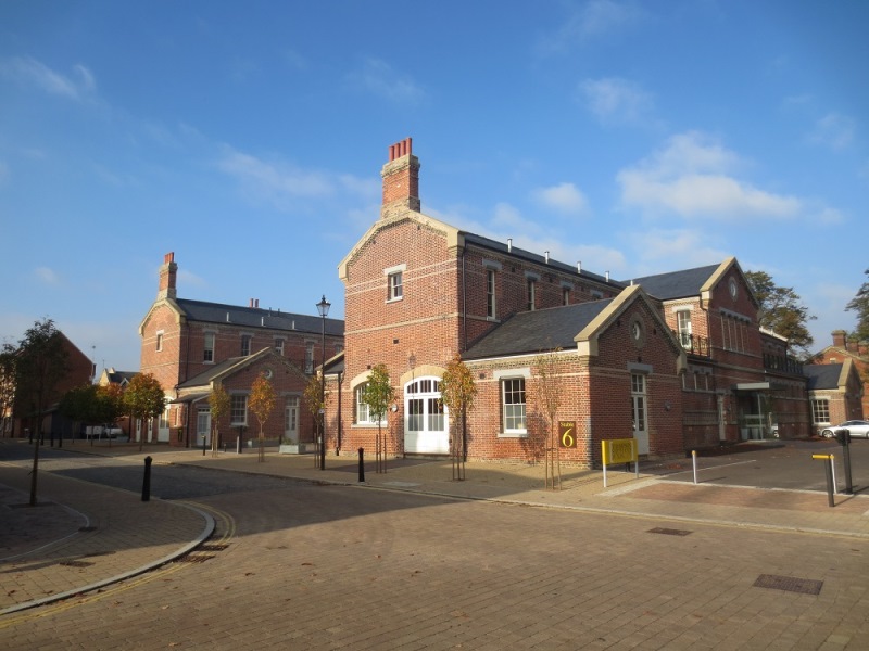
5 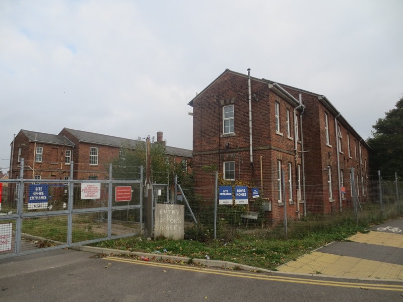
6 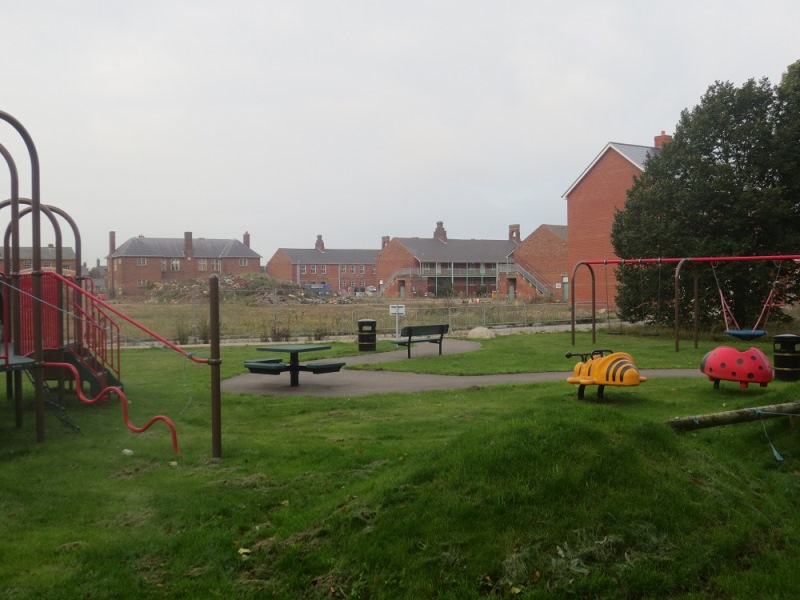
To see how these buildings once looked and were used, you can see more in the Colchester Images section of this website. Also our Colchester's Military Heritage section will offer further information.
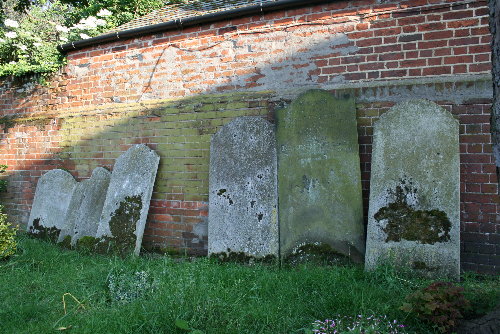
The following picture is of the 1856 built, Crimean War, church. It is the largest timber building in Britain and was made to a similar design to the wooden hospitals that were sent out for use by Florence Nightingale on the battle front. It became redundant in 2007 and an alternative use was sought. It became, once more, a place of worhip. The Orthodox Russian Church won their bid to take over the building. Good news for them and for our preserved heritage.
7 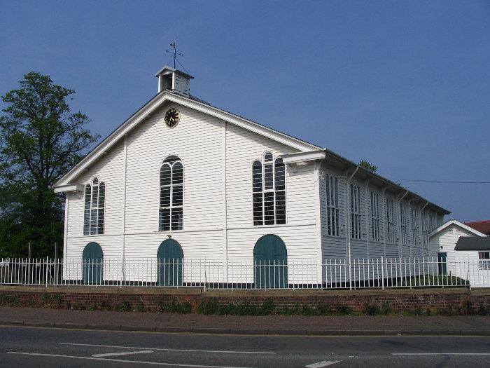
8 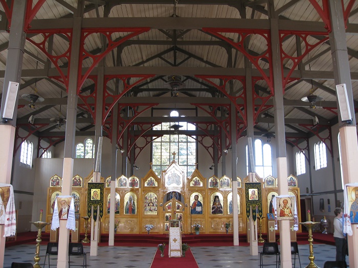
The church is built on a Napoleonic period graveyard, the grave stone below, one of several that have survived, to Thomas Morris, dating from 1806.
9 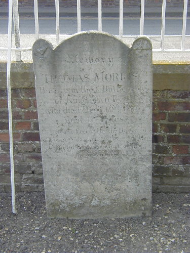
![]()
10 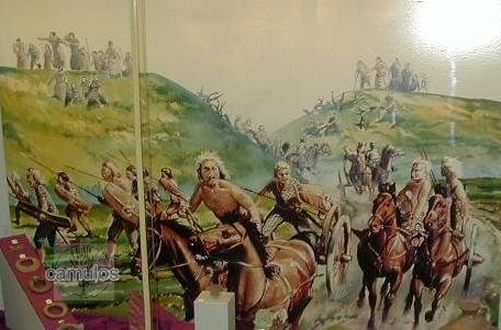
The Gosbecks Archaeological Park is located in the position where it is believed once was the heart of Iron Age (Celtic) Camulodunum. It is believed that it was here that some of the powerful tribal people, known as the Trinovantes, once lived.
These ancient Britons were renowned warriors who were adept at fighting from horse drawn chariots, making use of the protection given by their defensive dyke system (earth mound walls) that they constructed over the centuries. The area is relatively flat, the land fertile and free draining, and is close to what we now know as the Roman River. It was probably here that the Emperor Claudius came with his Roman army in the year AD 43 to take the surrender of several British tribal leaders (or kings). This was the seat of the most powerful of the British tribal leaders.
The Iron Age Dyke System - Camulodunum (fortress of the celtic war god Camulos) was protected by an extensive system of banks and ditches from the first century BC. These dykes (as they are known) helped to enclose an area of 12 square miles (about 3100 hectares), forming part of a complex series of defences which included the natural barriers of the River Colne and the Roman River. The main period of construction came under Cunobelin, who was known to the Romans as 'King of the Britons'. There were two main centres of activity within the dyke system. One at Gosbecks and the other at Sheepen. The outermost dyke on the west side was Gryme's Dyke, which was probably the last major addition to the system. It was constructed around the time of the Roman conquest of AD 43. Gryme's Dyke can still be followed for most of its 6km length. It consists of a 12 metre wide bank, much of which survives to more than half of its original 3 metre height. On its west side was a ditch, 9 metres wide and 4 metres deep, which is now mostly silted-up. There is also good evidence of the other dykes in the system. All have different names. In the past 100, or so, years, these dykes have been protected and nobody is permitted to do anything that might damage them.
Clear evidence has been found of a pre-Christian (Pagan) temple comprising a large square ditch with a single entranceway. It had an inner, four sided, roofed structure, although this was probably added by the Romans at a later date. The Romans clearly realised the social and cultural importance of this site and must have worked closely with the indigenous population to bring a civilising influence to a new Britain under Roman control.
Inside the temple area, there appears to have been a temple structure which was offset from centre, as can be seen in the picture below. This was clearly a site of great spirituality and is one that is of great interest to archaeologists and historians alike. Up until the 1980's the Barbour family had been farming the area. Deep ploughing techniques and the damage it can do to archaeological remains was of great concern and, in return for building planning concessions, the land that we now know as the Gosbecks Archaeological Park, was given to the nation (administered by English Heritage), whereupon the park became a protected site.
11 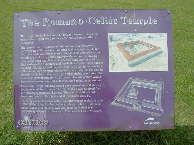
12 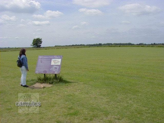
The original structures have disappeared in antiquity, their foundations extensively robbed out, the ditches filled in. The building materials were probably harvested several hundred years later to assist with the building of Norman Colchester. The interpretation boards show how things might once have been.
Colchester is unique in that it not only has the only Roman circus in Britain but it also has two Roman theatres. This is clear demonstration of just how important Colchester was to the Romans. The theatre that was discovered at Gosbecks is still possible to make out as a definite raised area, probably from a time when the tiered seating used grass turf. One of the display boards has a very grand looking structure which has been conjectured from archaeological evidence. Only five such theatres are known throughout the whole of Roman Britain - and we have two of them. Please see the virtual tour that deals with the Dutch Quarter of Colchester, for the other theatre. Please also remember that a theatre was very different to an amphitheatre. Roman amphitheatres exist in Europe and were used for sporting interests rather than the academic use of theatres. We don't believe that we would have had any Christians being fed to the lions or gladiatorial combats. The Gosbecks area, the original Camulodunum of antiquity, became the place where the indigenous British people could live in peace, watched over by their Roman masters a short distance away in what we now know as Colchester's town centre. With its temple and theatre, this must have become a place of peace and culture, rather than where the most powerful tribes lived and fought from.
13 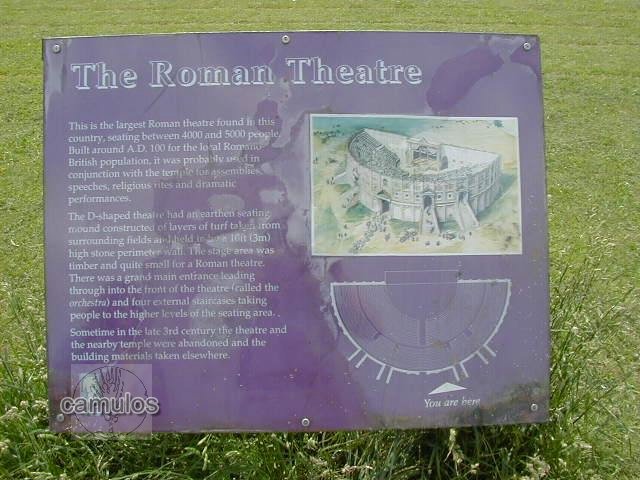
The Iron Age defensive dyke system which surrounds this site and is in evidence all around modern Colchester, are truly impressive and stand as a testament to the importance of the area, the like of which is not to be found anywhere else in Britain. The site is scheduled for future development as a place of historic interest, funding and further archaeological excavations being under consideration by English Heritage.
There were plans to build an interpretation centre here to explain the significance of this site. However, the plans had to be shelved, mainly due to a lack of the necessary funding. Meanwhile Sutton Hoo achieved what we failed to do. Today, the site is preserved as a large open space, very popular with dog walkers.
With a little imagination, one can take oneself back in time to a time when King Cunobelin lived here (around the years AD 4 to 40), with characteristic Iron Age round houses dotted about, smoke drifting through their roofs, livestock in pens, children playing, battle hardened warriors testing their skills with their weapons and chariots, etc. But wouldn't it be so much better if we had our interpretation centre with a reconstructed round house and an opportunity for modern-day people to experience how things must once have been? We tried, but Sutton Hoo got the money.
We cannot leave this section of our tour without mentioning the nearby Stanway site, extensively excavated by the Colchester Archaeological Trust in the 1980s and 90s (and more recently in 2015). The Stanway site was mainly a funerary site which appears to have started in the second or third centuries BC as a small farmstead which was later enlarged with the addition of enclosures to become a burial place. It lay beyond the outermost of the earthworks which protected Iron Age Colchester. Archaeological excavations took place to keep in front of the advancing face of the quarry that has since completely obliterated the burial site.
More information about Gosbecks may be found at our Camulodunum page on this website.
![]()
A short way away from Gosbecks is the church at Berechurch, where is to be found the Audley Chapel, a 16th century family chapel with a fine hammerbeam roof and monuments to the Audleys (of Thomas Lord Audley fame) and other families. The following pictures were taken during a Heritage Open Day in 2006.
14 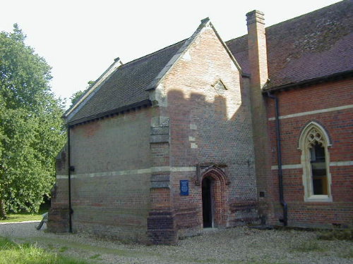
15 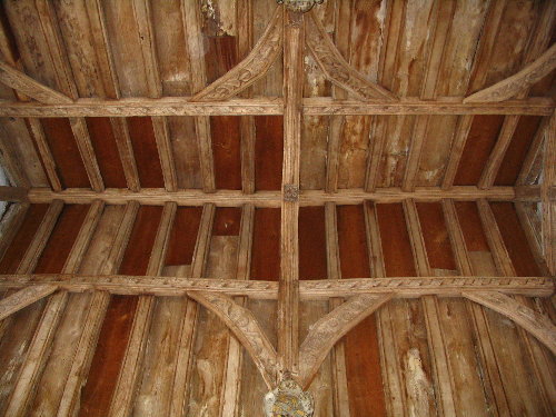 16
16 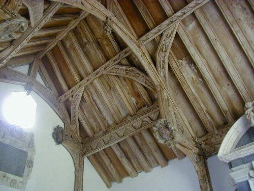
17 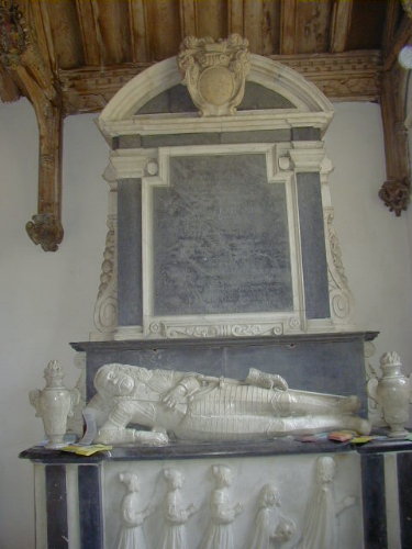
Outside the chapel, in the churchyard, is a tomb to the Ward family, recording the life of one remarkable man, James Ward.
18 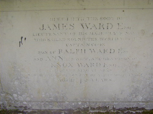
James Ward sailed on the third voyage on the Resolution as an Able Bodied Seaman (24) until 1st November 1777.
He then became a midshipman until 2nd November 1779 when he reverted to being an A.B. He was the first aboard to see the Hawaiian Islands in 1778.
The Ward family owned West Donyland, on the southern edge of Colchester. James's grandfather, Knox Ward, who was Clarenceux King of Arms from 1726 to 1741, acquired the property in 1736. At his death in 1746 it passed to his son, Ralph Ward. Ralph and his wife Ann were the parents of James Ward, who was born in 1761.
Ward attended the Naval Academy at Portsmouth from 1772 until 1775 where he became a close friend of Trevenen.
James Trevenen (1760 – 1790) was an officer in the Royal Navy and the Imperial Russian Navy. Born in Cornwall "of a very respectable family", he was educated at the Royal Naval Academy at Portsmouth and went to sea in 1776 as a midshipman on the Resolution under Captain James Cook, where he assisted Cook as a surveyor and navigator. On completing the voyage in 1780 he was promoted to lieutenant by the Earl of Sandwich, and sailed under James King, whom he had served with in Resolution, until the end of the war in 1783.
These notes were compiled by John Robson a New Zealand member of the Captain Cook Society.
The memorial inscription above states that he sailed the world with Captain Cook.
![]()
EARLIEST CHRISTIAN CHURCH IN BRITAIN?
19 
Just outside the Head Gate area of the Roman Colonia, adjacent to the present day Police Station, was discovered the remains of a church like structure, dateable to AD 320 - 340. The Roman Empire officially became Christians in 313 and this church may well be the earliest known Christian church in Britain. In Roman times, the dead were not allowed to be buried within the walls and a vast area in the vicinity of this church was used for both post and pre-Christian burials, identifiable by whether they were inhumations or exhumations. Literally hundreds of graves have been excavated by the archaeologists, mainly in the 1970s, although many must have been destroyed in Victorian period when the area was quarried for sand and the land used for buildings.
See the Colchester Roman Trail for more information.
~~~~~~~~~~~
20 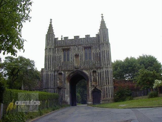
A short distance away towards St Botolphs, but still outside the walls, St John's Abbey was built in the latter part of the 11th century. The abbot of St John's became a very powerful individual, much hated by the townspeople. There is now no evidence of the original building which fell into decline after the dissolution of the monasteries in the 16th century. Part of its buildings became the home (around 1560) of the Lucas family but now, all has gone, with nothing of the period to be seen but the gate and St Giles Church close by.
21 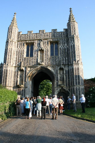
These pictures were taken during a guided tour in June 2008.
22 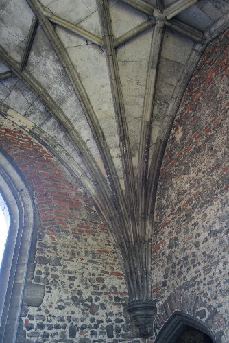
This shows the stone vaulting of the gateway giving a clue as to how magnificent the abbey itself must once have been.
23 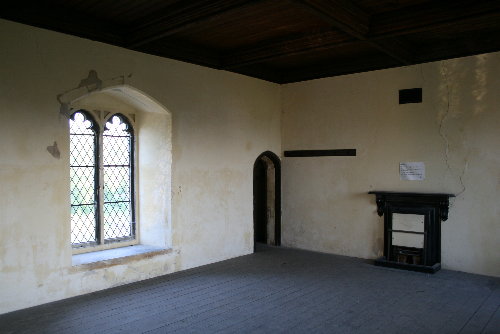
This is a view inside the room above although this was a result of the substantial refurbishment of the gateway done in the 1870s, when the building was in a very poor state of repair. The room is accessed by a very narrow spiral staircase.
24 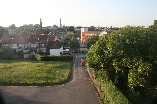
This is the view to the north from the window. If the St Botolphs redevelopment goes ahead, the view will change considerably from this in the future.
25  26
26 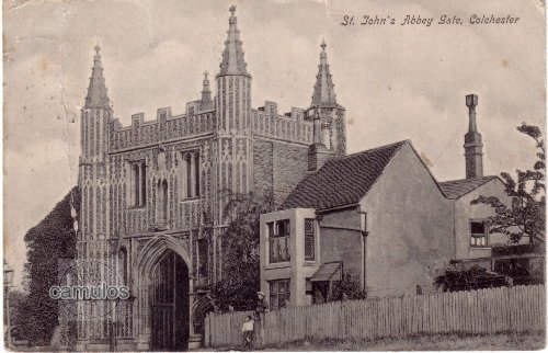
Compare this view today with the postcard below, dated around 1904.
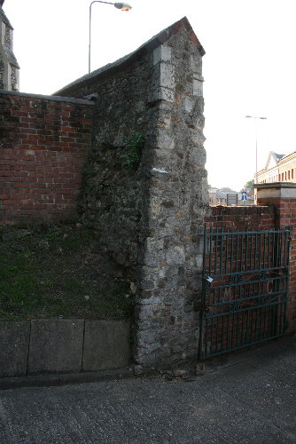
Taking a walk around the perimeter of the site, one can see plenty of evidence of the abbey wall and some of its re-used materials.
27 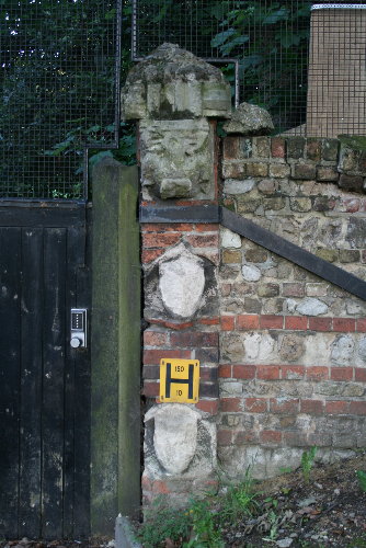 28
28 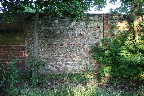
Here, a doorway into military premises shows various stone carvings that must once have decorated a section of the abbey. Also, evidence of the abbey's outer perimeter wall in Flagstaff Road, with evidence at low level of drains or windows. Note the use of reclaimed Roman materials.
29 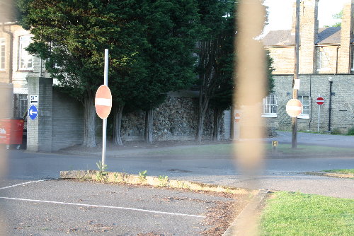
The above is a view through the perimeter fence of a section of the abbey wall that was scheduled in the 2010s, such was its importance. Its position is directly over the east end of the 'spina' that, some 1800 or so years ago, was part of the recently discovered Roman circus. For more details of that amazing discovery, please go to the Colchester Roman Circus section. All of this area (in 2016) was part of a site that was being developed for other uses, since the garrison had moved away to another part of the town.
But before we go, the following images are taken from the only picture that is known of St John's Abbey, which date from the 17th century. In recent times, a replacement Officers' Club was built on the site of the abbey, to replace the previous club that had burned down. Before that could happen, the archaeologists went in to see what evidence could be found of the abbey's exact location. With the help of this picture they were able to show that the picture's architectural features were accurate. So there we have it, Henry 8th and his marital difficulties have a lot to answer for.
30 31 32 33
...and so, the impressive St John's Abbey gate is all that still survives of this once great monastic building, as does some of its perimeter wall along Mersea Road. The nearby St Giles church, part of the St Johns Abbey complex, still stands and is now a Masonic Hall and Banqueting Centre..
![]()
ST GILES
The church of St Giles was made redundant in the 1980s and it saviour was the adoption by a Freemason Lodge who took it on as their base and which has ensured its future. Now closed to the public, we were able to visit with a group in June 2008, when the following pictures were taken for this, your vitual tour of St Giles Church.
34 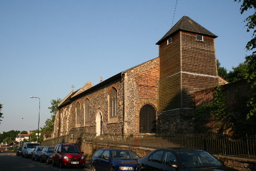
A view from the north west.
35 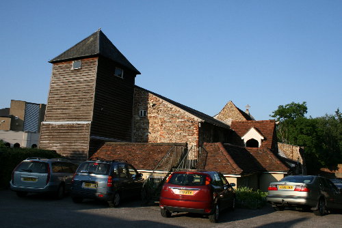
A view from the south west. The church graveyard was converted into a car park and many of the graves were desecrated and removed elsewhere, including the remains of the Lucas family.
36 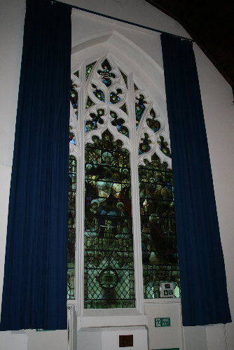 37
37 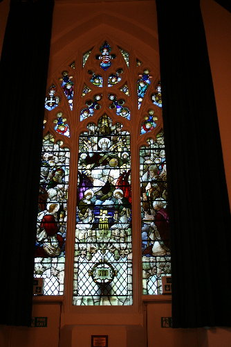
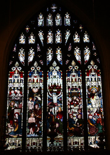
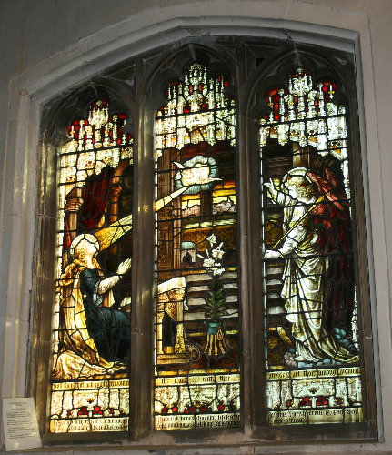
The church has many fine stained glass windows (presumably from the Victorian period).
38 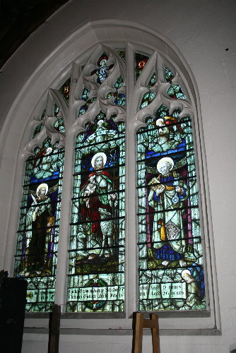 39
39 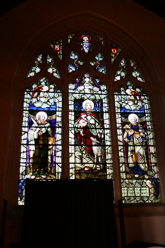
When we visited, the church was laid out in readiness for an event for members of the Lodge. The masons keep the building in very good order.
40 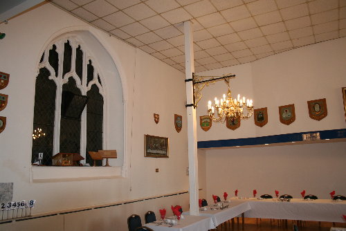
Bottom left of the picture above, on the south wall, is to be found an inscription to William Cock; a colourful incumbent of the church in the early 17th century.
41 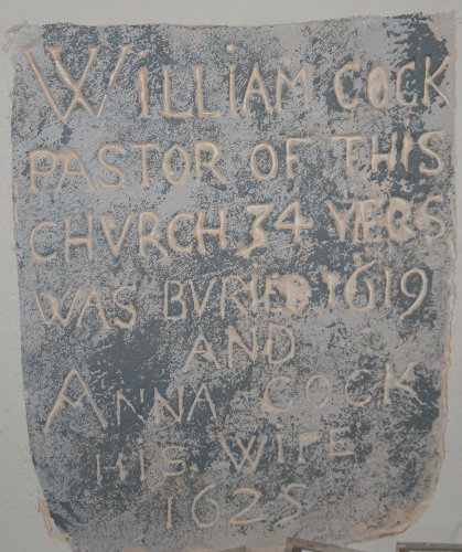
Elsewhere are two coffin plates, rescued from coffins belonging to the Lucas family. They were Royalists, and the families tombs had been desecrated by the Parliamentarians during the civil war. It was a time in England's history that brought out the worst in men with atrocities committed by both sides. It is little wonder that we protect our monarchy now for fear of the alternative that Oliver Cromwell brought upon us.
42 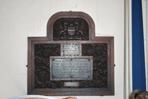
...and below, a closer view of the plates.
43 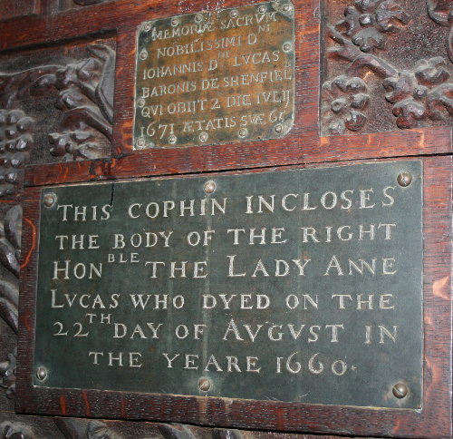
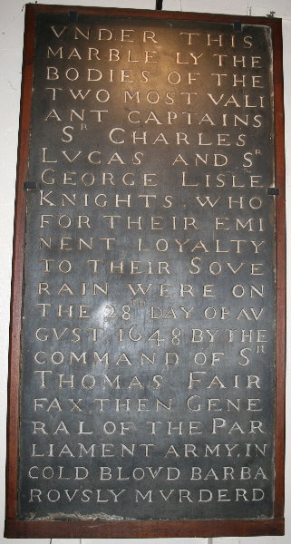
Below is the stone slab that once laid in the floor of the church to cover the remains of two heroes of the Civil War - Sir Charles Lucas and Sir George Lisle. Both were executed by Cromwell's men after the Siege of Colchester in 1648. On the restoration of the monarchy after Cromwell's death, King Charles II was to have his revenge on the parliamentarians. 44
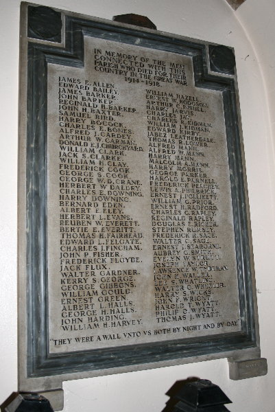
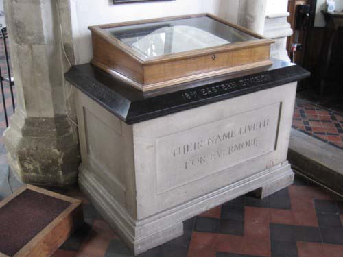
Also in the church is a memorial to the the men of the parish who gave their lives during the 1914-18 war.
45
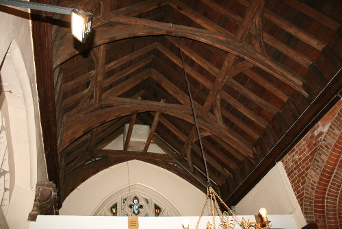
Below is a view of the roof structure of the church.
46
......and outside again to see how the church has been modified over the years.
47
A few gravestones survive but most have been lost or destroyed.
48
As we have already seen, the original St John's Abbey wall survives in places, the section below having been cut through to give access to the car park behind the church.
49
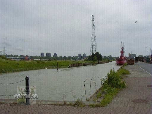
The Essex University tower blocks and building were constructed in the 1960s and stand to the east of the town, towards the town of Wivenhoe. The picture (looking east) below shows it in the distance, with King Edward Quay in the foreground. The Hythe area in general, has undergone great changes since it was closed as a working dock in 2000. One assumes that the Romans would once have brought their goods to Colchester via this river - but how far up was it navigable?
50
See Colchester Images for many more pictures of the Hythe.

on Hythe Hill
A redundant church, although you wouldn't know it.
It has an active bellringing group and services are held at certain times. It is usually open to the public on Heritage Days. Photographs of the war memorials inside the church are shown elsewhere on the Colchester Heroes pages.
51
52
53
54
55
56
57
58
59
60
61
We will now come away from the Hythe and all its charms, and head back towards the town centre,
EAST HILL and THE MINORIES, EAST HILL HOUSE and ST JAMES THE GREAT CHURCH
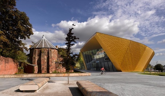
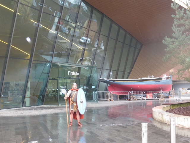
This area of Colchester is underwent great change with the building of our new art gallery, known as Firstsite.
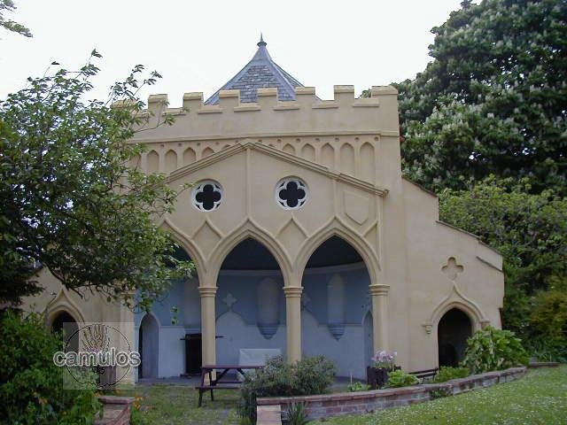
The Minories, an 18th century building that was built by a wealthy bay maker, William Boggis. Until recently, it served as one of the town's art galleries, with a very popular tea room/cafe/garden area. The following picture is of a folly building that stands in its gardens.
62
This curious looking edifice was, so we are told, used for performing medieval passion plays - an eccentric interest of the owner perhaps?
62a
The above picture shows the folly from behind, together with Firstsite.
62b
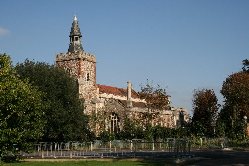
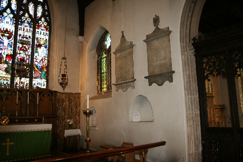
St James the Great on East Hill is one of our oldest churches.
This view is looking in a north easterly direction.
63
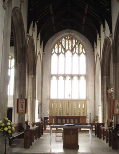
Here follows a few pictures of the inside of the church.
64
65 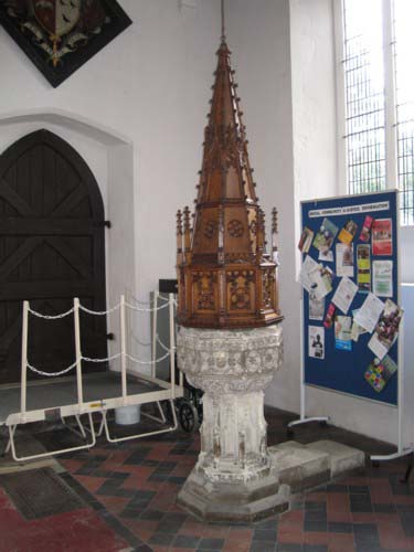
The Font
66 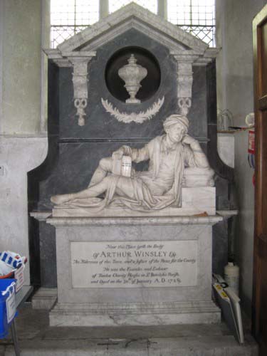
Arthur Winsley's Monument
67
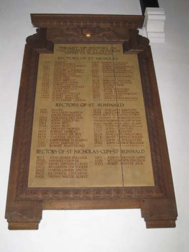
A list of incumbents from St Nicholas and St Runwald Churches, both demolished.
68 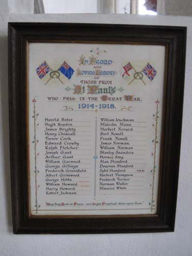
Roll of the Fallen from St Pauls Church, also demolished.
69 70
Some much older views of the church can be seen in the Colchester Images section. As we leave the church, the picture below is of, perhaps 18th century, carved letters in the brickwork wall opposite to Greyfriars, to mark the dividing line of the ward boundaries between St James and All Saints parishes. The town was divided into areas known as 'wards', a system that still applies today, especially for borough councillor areas of responsibility.
71
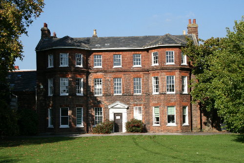
Adjacent to the church is East Hill house. This view looks north. The building was sold in 2008 for development so it will be interesting to see how this view has changed in years to come.
72
Below is a view looking north east of what is known as Greyfriars, a name given to the original buildings that stood on the site from when it was a friary with grey clothed friars. Friars go out and about to preach, Monks do not! Again, like East Hill House, this building was recently been sold for development and became what was fancifully termed, a 'boutique hotel'. There are more pictures of this building in the Colchester Images section.
73
On
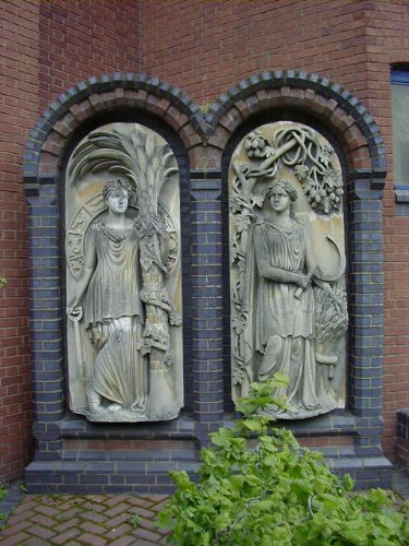
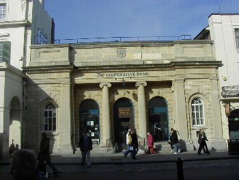
...we have some fine sculptures at St Mary's car park, which was opened in 1981. Those shown in the following picture originally came from the two niches (now windows) in the building previously known as the Albert Hall in High Street (shown inset, one modern day, one 1870s). However we cannot be sure that they were the actual ones shown in various old pictures of the building, as they look quite modern. They may have been intended for replacement of older ones. Can anybody answer this for us please? It later became the Co-operative Bank.
The building was built in 1845 as our corn exchange, then becoming our reperatory theatre and, finally, after a period of redundancy in the 1970s, a bank. These two sculptures are (we believe) depictions of the Greek goddess Demeter (known by the Romans as Ceres) and were intended to represenent ancient and modern agriculture. They may have been made to designs by Raphael Brandon. Demeter was the sister of Zeus. Her name means "barley-mother" or "mother earth" and goddess of fertility. Sacred to her are livestock and agricultural products (with the emphasis on corn), poppy, narcissus and the crane. In the left hand sculpture she holds a spade. She is holding on to a tree of some sort. There is also a ring of various signs of the zodiac. In the right hand sculpture she holds a sickle and a sheaf of corn. An elaborate vine is also depicted.
74 75 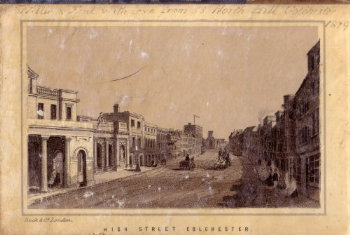
76
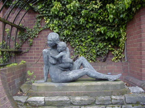
A short way to the south is a beautiful sculpture by local sculptor Shirley Morrison entitled 'Mother and Child'. It was placed into a specially constructed 'grotto' shortly after the statue was created in the 1980s. Why this choice of subject was made, we do not know.
77
(see ECS 04121981 and ECS 02061972 and ECS 09061972)
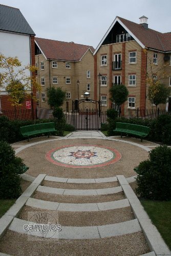
Just a short distance away from these sculptures, up the hill and into the recently built 'Balkerne Heights' development, is to be found this very attractive communal area and, in particular the modern mosaic that is its focal point. This piece of Roman style work, created by Ann Schwegmann-Fielding, was unveiled by the Mayor of Colchester in June 2006 (ECS 090606).
78
There are 17 other sculptures in the form of murals, produced by artists Henry Collins and Joyce Pallot in the 1970s and located in various underpasses that were built during the development of Southway. Some are shown here but these and other examples of street art may also be seen at Colchester Street Art.
The following three pictures are further murals from Kingsway in the town centre, just off Queens Street.
79
80
81
The following murals are taken from the Southway Underpass by Abbeygate Street.
82
83
On
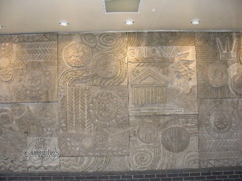
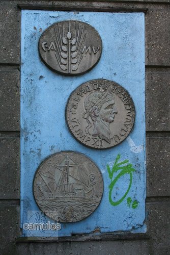
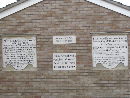
...can be seen restored monumental inscriptions taken from Finch's Almshouses that once stood on the site and which were built into the wall of one of the newly constructed houses.
84
All Christian preachers will know the name of Charles Haddon Spurgeon; perhaps the greatest Victorian period preacher that ever there was. He was born in Kelvedon but grew up in Colchester. He was 'converted' in this modest little Primitive Methodist chapel in Artillery Street in 1850.
85
86
.....and finally, back to our wonderful castle......
....to parts of the grounds that are not generally visited on the standard walking tour.
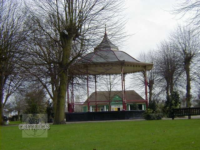
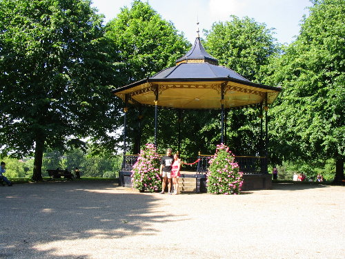
87
The Victorian Bandstand, winter and summer.
88
Followed by images of the area known as Duncan's Gate in the north face of the Roman wall.
89
90
At the foot of the park, on the north face of the Roman wall, was discovered a postern gate, named Duncan's Gate, in memory of the Victorian gentleman who discovered it. It is closed off to the public because of its poor condition and because of the presence of an impressive drain that passes underneath it. This drain is at least 100 metres in length and runs up the hill towards the castle. Some time in antiquity, probably in the last years of the Roman period, it appears that the gateway was destroyed by fire, the top archway of the structure collapsing and still laying where it fell. The steps shown are a modern addition.
91
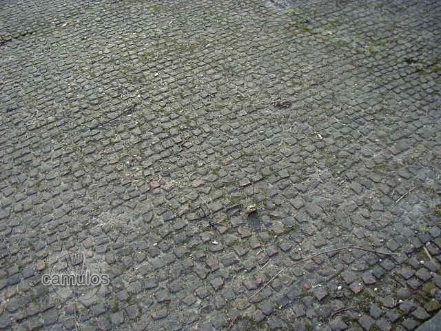
A later archaeological excavation uncovered evidence of Roman period houses in the castle grounds. This picture above shows the original tessellated floor surface, still good after having been exposed to the elements since the 1930s, when it was discovered.
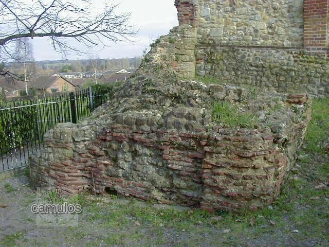
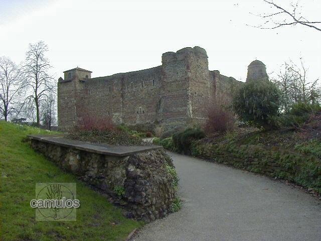
92
A short distance away may be seen a section of the perimeter wall that would have formed a boundary around the Claudian temple, the site of which lies under our magnificent Norman castle, as seen in the background. In order to make a pretty pathway, this archaeological treasure was broken up. It would never be allowed to happen today! Indeed this section of teh temple wall passes under the later Norman castle bailey, and we must assume that the rest of it is still intact.
93
94
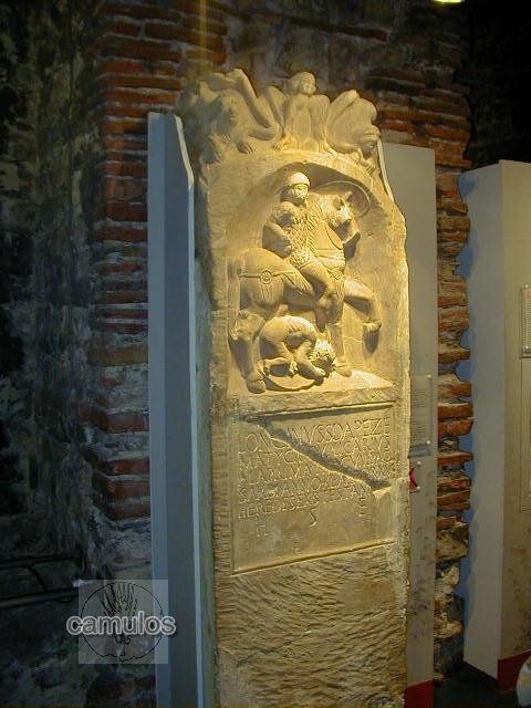
These pictures show just one of the Roman stele (but perhaps the most impressive) that has been discovered and now housed within the Castle Museum. This is the tombstone of a Thracian Auxiliary Cavalryman by the name of Longinus Sdapeze, dated to the 1st century AD and perhaps thrown to the ground in disgust by Boudicea's forces during their rampages. There it lay for almost 2000 years, until its chance discovery in 1928 by local workmen. Its carved stone was never worn by weather, so it is as if were carved only yesterday.
95
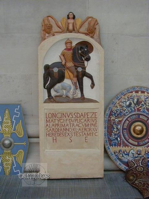
This picture is of a modern copy of the stele, now held in the British Museum. It shows how the original item might once have looked. The inscription reads:
Longinus Sdapeze
Matygi duplicarius
ala prima T(h)racum pago
Sardi(ca!) anno(rum) XL aeror(um) XV
heredes exs(!) testam(ento) [f(aciendum)] c(uraverunt)
h(ic) s(itus) e(st)
Roughly translated as:
Longinus Sdapeze, son of Matygus,
from the town of Sardica duplicarius of the Ala I Thracum, 40 years of age, served 15 (years),
lies here. His heirs had (this tombstone) set up by testament.
Or, in other words, Longinus Sdapeze was the second in command of a Thracian cavalry unit, an auxilary soldier (not a Roman, but a mercenary soldier). Longinus was his Roman name, Sdapeze was his tribal name. He died in Colchester after fifteen years of service to the Roman army. It indicates that the 40 year old Longinus was born in the area of the modern day Sofia, capital city of Bulgaria. It reveals that he was a duplicarius, one of the highest paid cavalry positions. His heirs erected the tombstone, according to his will, probably funded from the contributions given by fellow soldiers to provide such a stone. Longinus died around AD 49, soon after the invasion in 43, suggesting that he may have come to Britain with Claudius's invasion force, and possibly marched into Colchester in the emperor's procession. It is the oldest Roman gravestone in Britain.
The tombstone shows fine detail of his attire, in particular, detail of the scale-armored cuirass (lorica squamata), a coolus helmet, an oval shield and the elaborate bronze phalerae covering the strapping on the horse’s harness. The fallen warrior (presumably representative of a Briton) is in a foetal position being trampled underneath the horse. A powerful message, bound to have angered the indigenous population. His spear has been broken in antiquity.
If you would like to see a little more of the inside of the castle, please go to the Colchester Castle page.
THE END
Please tell your friends about this site - or better still, visit our wonderful town and see it first hand. If you would like to leave a virtual tip, sorry, we have gone to the virtual pub for a virtual pint of beer. See you down there! To revisit any part of the tour, please click on any of the following:
or return to the
Home Page
since 280502
but last updated
011121
Need to add pictures of Greyfriars and East Hill house. Almshouses. Bourne Mill. Mercury Theatre.